BC Tour — Smithers to Prince Rupert

confluence
The Bulkley River (left) flowing into the Skeena River (right)… By Heqs – Own work, CC SA 1.0, commons.wikimedia.org/w/index.php?curid=1144022

It’s all downhill from here (a favorite cliché in cycling). At least until I get back on land at Port Hardy. This segment starts at Smithers on the Bulkley River, which joins the Skeena River. Of course they both flow downhill. This is wild country, with lots of snow, a primal feel, and friendly people. The Skeena is a beautiful river, powered primarily by snowmelt.

The Skeena was navigated by canoe for centuries, then by mule train, and soon by steam boat. Many believed there was a fortune to be made in the area above Hazelton when plans for a railroad were announced. Hazelton was the staging area for the Omineca Gold Rush, and was widely advertised as the “Spokane of Canada”.

drainage
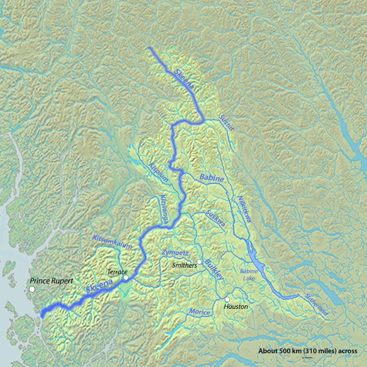
This segment of my route followed the Yellowhead Highway, which follows the Bulkley and Skeena rivers. My stops were Seeley Lake Provincial Park, near New Hazelton (at the confluence of the two rivers); Kleanza Creek Provincial Park, just before the bigger town of Terrace; and Park Avenue Campground, in Prince Rupert. To borrow a phrase from Duke Ellington, this ride was “beyond category.”

Hazelton and the Seeley Lake

I had an unusual experience on my way to Hazelton. After a few hours on the road, I felt so groggy that I feared I would fall asleep as I rode. I fought it off for a couple of miles, but decided I had better take a nap. I rolled my bike into the grassy ditch, propped my head on my sleeping bag, and went to sleep. I worried that some random Samaritan would interrupt my slumber, but I don’t think a soul stopped to investigate. I recovered after a half hour or so, and continued on my way.

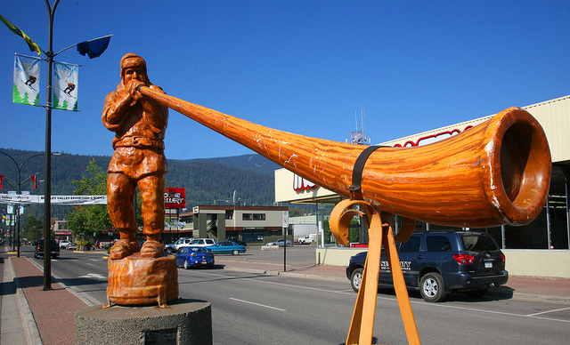
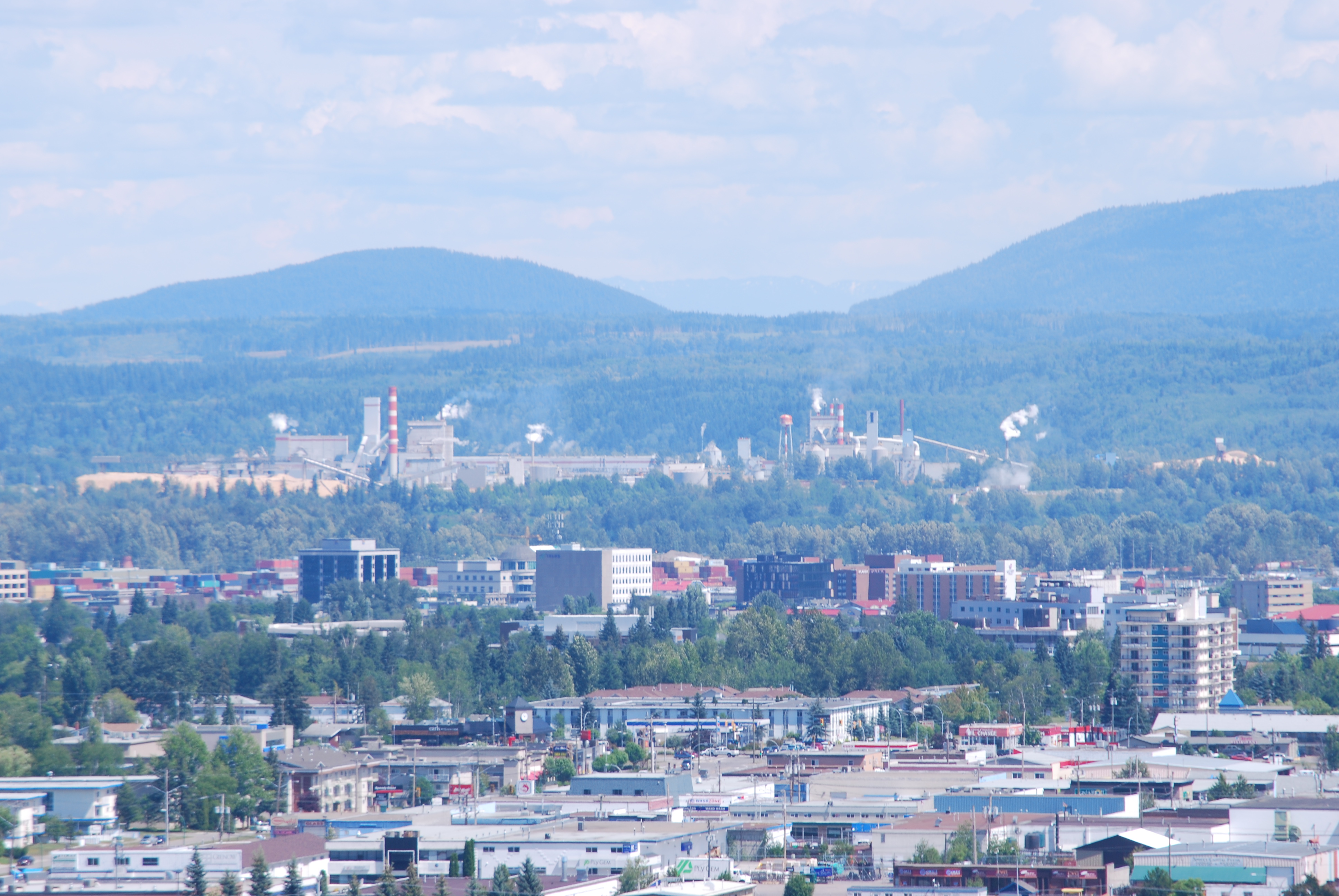
I stopped in New Hazelton on the way to Kleanza Campground at Seeley Lake, which is near the Skeena River. The Hazelton region is located upstream from there at the confluence of the Bulkley and Skeena rivers. New Hazelton is the biggest town in that region, but is small by most measures. Still, it has all the services for day-to-day living, in particular a laundromat, which eventually becomes a necessity for a bicycle tourist.

The laundromat served as a social club as well as a laundry. An attendant and a few of her friends were drinking coffee when I arrived. I saw that they had a “washroom” there, and changed out of what I was wearing into street clothes. After loading the washing machine I sat down to talk with the coffee clutch. I told them about my nap attack on the road, and they had a good laugh.

They wanted to know where I was going, what I ate, if I have a tent, etc. There was an old fellow there washing clothes too. We talked about the bicycles he had when he was younger, and I asked him about the Cassiar Highway. I heard about the Cassiar when I talked with Thane a few days before, and had already put it on my bucket-list. One thing I remember is that it passes through a dry area that only gets about three inches of precipitation per year.

The attendant described another bicycle tourist who stopped at the laundromat a few years before. It might have been my HP friend Jake Layte. After I got my clothes washed and in the dryer, she offered to watch my bicycle while I shopped for groceries. Soon after that I was on my way to Seely Lake. It had been an efficient and enjoyable stop in New Hazelton.

Kleanza Creek Campground

downstream
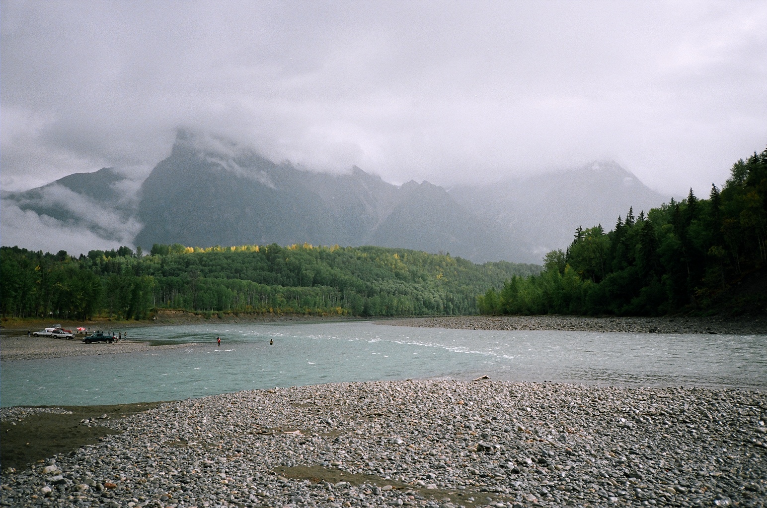
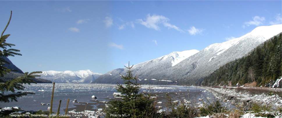
Yellowhead Highway runs alongside the Skeena River between rugged mountains on the way to Kleanza Creek. I was there in the spring when the snow was melting. The river was about as I expected — 100 yards wide, and flowing at 12 miles per hour, according to my speedometer. It appeared to be at least 20 feet deep. That’s a lot of water. Splendid.

When I talked with Thane outside Houston he recommended that I eat at “Mothers” restaurant in Kitwanga where Cassiar Highway joins the Yellowhead. I crossed over the river to the tiny town and ate breakfast there. The food was not equal to Thane’s rave report, but I had a long chat with the new owner. Then I visited a native-arts place at his recommendation. There was a large collection of totem poles alongside the road, and the art was interesting, but there was no room for any of it on my bicycle.

steamboat
Sternwheeler struggling up Kitselas Canyon on the Skeena.

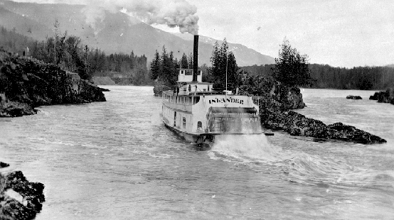
Then I was back on the road again, headed to Kleanza Creek Campground near Kitselas Canyon on the Skeena. It took a few years of trying and some wrecked boats before they were able to get sternwheelers past that point, and on to Hazelton.

A woman came over to talk with me while I was setting up camp at Kleanza. She and her husband had seen me on the road several times, and were impressed with how far I had gone. They had a camper, and obviously were enjoying a leisurely journey down the highway.

On to Prince Rupert

panorama01
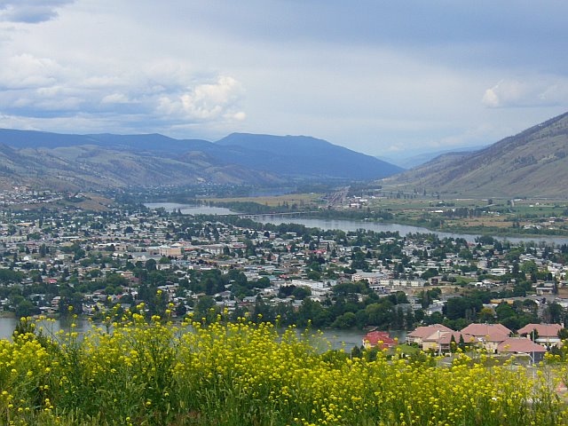
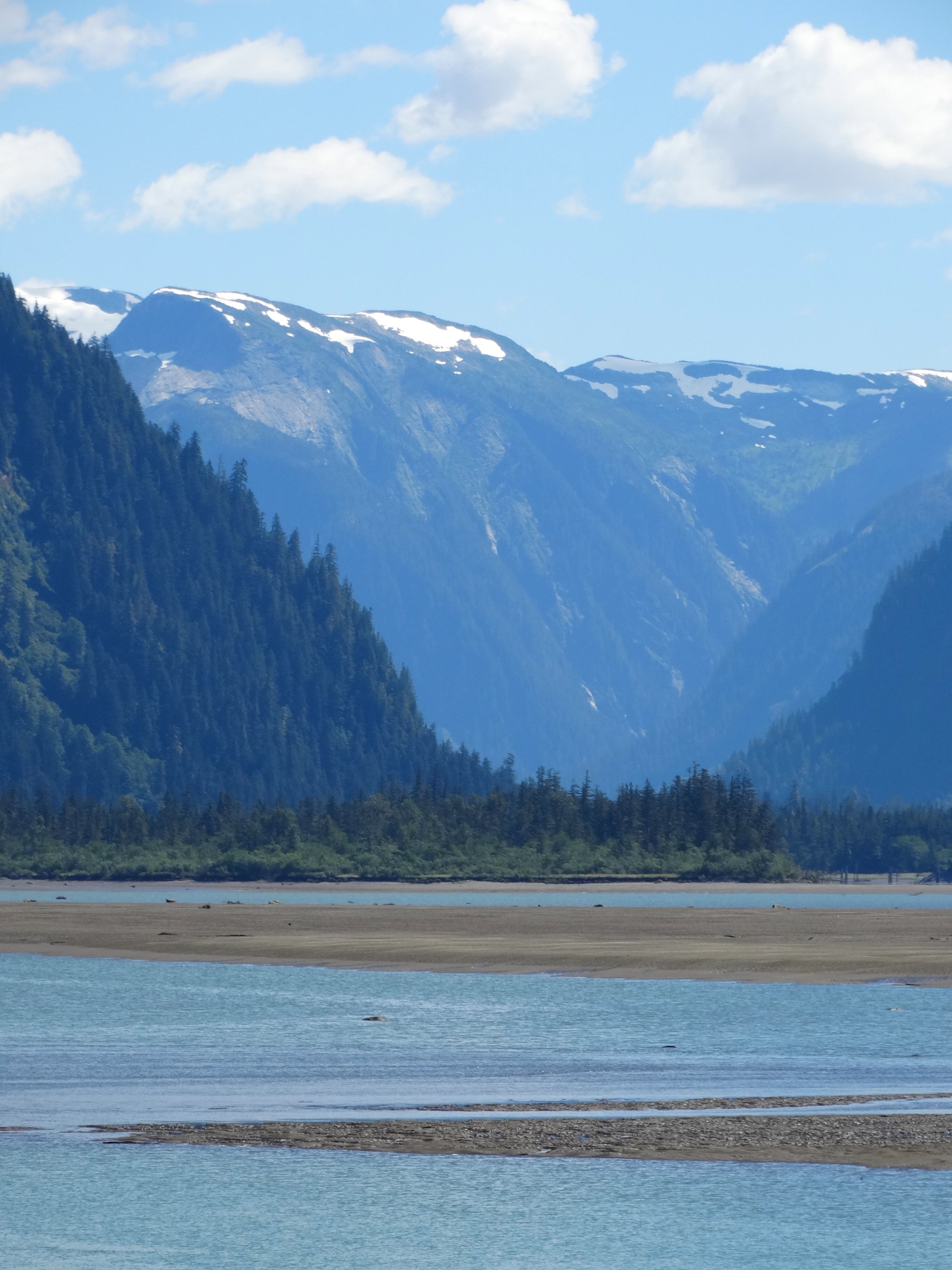
This was a 100 mile day. The Skeena becomes an estuary (salt water mixed with fresh water) about 25 miles from Prince Rupert. The vista widens and seems less foreboding than it is further upstream. The estuary is actually the channel that was formed during the ice age and is now drowned by the Pacific ocean.

In a couple of hours after reaching the estuary I was in Prince Rupert, which is actually an island reached by a short bridge. I was soon in the Park Avenue Campground, setting up my tent. You do not want to wait until later to to do that in this country (Prince Rupert is the city of rainbows). The grass is perpetually wet in the campground, and the ground slopes, but there were raised wooden platforms for tents. It was all good.

To be continued…

Prince George — Smithers

I’m now on the Yellowhead Highway. Vanderhoof, Burns Lake, Houston and Smithers are my stops in this segment.

Vanderhoof

My stove quit working right last night, and I couldn’t find the tool to fix it with. But this morning I discovered a small box of spare parts that I overlooked yesterday. The stove repair kit that I needed was in it. I’ll fix the stove later. I’ve also been keeping an eye out for canisters that fit this stove (a story for the future). I have not seen any here in BC. It’s a good thing I took my old gasoline fired stove instead.

george-smithers1The ride from Prince George was tough. It rained and sleeted on and off, with strong headwinds. On top of that, the shoulder of the road was not paved. I had to get on the gravel shoulder and wait when traffic came from both directions. I’m now at Vanderhoof, which is 819 miles from home, or 68 miles per day. It’s 385 miles to Prince Rupert from here. Or as they say around here, “Rupert.”

The campsite is beautiful. It adjoins a waterfowl sanctuary at a wide spot on the Nechaco River. It is full with snow melt, so the ducks, geese and swans seem to be somewhere else on the river. The caretaker came over to tell me about the amenities here and in town. I’ve decided to stay over another day to rest and catch up on domestic chores.

There was more rain and sleet this afternoon, then some sun. I got my gear reasonably dried out, took a shower and went to Main Street to eat. My notes say it was a nice dinner, and that I had a good night’s sleep (up at 5:30).

The sun is shining on my day off, so it’s time to put things in order. I cleaned the cogs and put on the new chain that I bought in Prince George. Next, I fixed my stove. In the process, I found that an “O-ring” was cracked. I wasn’t surprised. I’ve used that stove on many backpack trips. No problem though. The repair kit had an O-ring in it too. My panniers (bicycle luggage) also needed to be fixed to keep more of the water out.

Then I went to the mini-mall that the caretaker told me about to get my hair cut. I wandered around town in the afternoon, and met a retired jewler there. We had a nice long chat. He is 70, and does a lot of fishing. Of course that’s a principal sport up here. I mentioned the recent rains, and he guaranteed they were over for a while.

Burns Lake

Time to get on the road again, headed for Burns Lake. I have a nice tailwind. The black flies (blood sucking pests) are out in numbers. Stopped at a KOA campground at the lake, because it was getting late. It was a bit primitive, but OK. Rode four miles to Burns Lake (the town) for groceries after setting up camp. The next day I am going to Houston.

Houston

Right after I rode through Burns Lake the next morning, I ran into the black flies again. I was riding up a steep hill at about 5 mph, with a 5 mph tailwind. In other words, the flies were drifting right along with me, and nibbling away. After a while I reached the top of the grade, picked up speed, and left the flies behind. What a relief.

The ride to Houston was interesting. I stopped at a restaurant at Topley that was just getting started again. I was the only one there. The new owner asked me where I wanted to sit. I asked her where she wanted me to sit. She said, “Anywhere you want to sit.” So I sat at a big table that was where I thought it would be convenient for her.

Presently an older woman came in and sat down across the big table from me without saying anything. Eventually she said, “Well, it finally got warm.” I told her how cold it had been in Vanderhoof, and that I was glad it was warmer now. We talked a while, and then two more women came and sat at the table. Then the first woman’s husband came in, and joined us. Evidently I had picked their usual table, but that didn’t deter them. My notes say we had an interesting conversation, but I remember nothing about it.

I soon left to start riding again. About five miles out of town, I met another bicycle tourist coming toward me. I crossed over the highway, and we had quite a talk. His name was Thane. He was around 30, and was using money from a voluntary severance agreement to travel. He started in Homer — on the Kenai Peninsula southwest of Anchorage — and rode up to Fairbanks. Then he rode to upper BC on the Alaska Highway, and down the Cassiar Highway to the Yellowhead highway where we met (about 2,000 miles).

Thane was on his way to Vancouver, BC where he would join his brother and ride to San Francisco. From there he hoped to ride all the way through Mexico, Central America, and Chile to Tierra del Fuego (if his money held out). It would be summer down there if he made it. There’s not many people who would ride for six to eight months.

Houston is a small town: “Where the welcome is warm and the wilderness beckons.” There is no water at the campground, so I went for water at the senior center in town. I met a resident who was from Denmark there, but I don’t remember his story. I had couscous and chili for dinner. I found it was easy to fix, a good combination, and satisfying. I plan to ride to Smithers tomorrow.

Smithers

Alpine HornSmithers was established by Swiss immigrants about 100 years ago, and is now a tourist destination. The town requires buildings in the downtown region to have an alpine theme. That ties in with Smithers’ world-class skiing. (When I was there, there was still a lot of snow on the ski mountain, which is right out of town.) Residents of Smithers are called Smithereens.

I went to the Town Center to find out where I could camp. The campground is a half mile out of town on the Bulkley River. After setting up camp, I went back to town to find a bicycle shop. My headset (bearings for the fork) was still not stable. The owner and I talked about touring while he did what he could to fix it. He wouldn’t take any money, so I thanked him profusely. (The steering worked better, but not for long. I eventually used duct tape to make it stay fixed.) $nbsp; 😀

A bunch of rowdy locals, like the ones at 100 Mile House, were at the campground when I got back. Louise and Bob (not rowdy types) came over to talk, and offered me a beer. They have a cabin up on the Babine River, which is famous for steelhead fishing. It’s about 100 miles away, and they get to their cabin on a river boat. They have spent a couple of winters up there too. (The beer tasted very good, and the locals’ loud music didn’t keep me awake.)

BC Tour — On to Prince George

100 mile house to prince george
© Google Maps Click for a navigable map.

I was going to take back my tour when we left 100 Mile House. I had decided to stop pleasing Bob, and be honest with him. After all, it was my tour. I knew I couldn’t keep up the pace we’ve been on. I wasn’t as strong at this point as when we started. I was not going further than Williams Lake today. Bob can do as he likes after I that.

We’re back in rolling hills today. It’s 57 miles to Williams Lake, so won’t be worn out when I get there. We came to a present-day version of a roadhouse, AKA travel center, near 150 Mile House. It catered to truckers and travelers, and was quite nice. There were two or three food vendors, conveniences, and other services. Almost a self-contained village. Of course they had gasoline and diesel but we didn’t need any of that.

We took our food outside and sat on a bench. After we finished eating, I sat there looking at the scenery. I knew Bob was itching to get going again, but I didn’t let on that I noticed. Eventually he said we needed to get going. He wanted to “get some miles in.” (He had to catch a ferry on the 17th but we would have easily made it there on my original schedule.) I told him I was in no hurry, because I was going to camp at Williams Lake, which was several miles away. So he left on his own, and a while later I went on too.

Williams Lake is a lumbering town, with a compact downtown, much like Crosby, MN was back in the day. I camped at Williams Lake Stampede Campground (there are lots of stampedes and dirt track racing at BC towns). I went downtown to buy a camera after I set up camp. The rain had crept into the camera that I started off with. I also picked up groceries, and came back to eat. Then I took a shower in their nice facility, and went for a ride around the town and over the Fraser River bridge.

A couple who were also bicycle touring were the only other people there. They were riding “South and West.” I told them about my plans and experiences. They were just following their noses though. The campground caretaker came around to see if we needed anything.

Later on a young woman with her two year old stopped by. She and her husband were interested in cycling. I showed her what was involved in living on the road, and how it had been going for me. My afternoon there is a good example of the magic connection you have with people when touring by bicycle. Most of them feel comfortable approaching you, and they ask all kinds of questions.

I had Mandarin oranges, oatmeal and carrot-raisin muffins for breakfast, and started out for Quesnel the next morning. The highway follows the Fraser River at this point, so it was uphill all the way. It turned out to be hard, but not to hard. I still needed more recovery before I was able to resume the pace I had originally planned.

Along the way I saw a sulfur train snaking around the bends of the the Fraser River. I was high on the shoulder of a hill beside the river, and I caught it out the corner of my eye. The sulfur was in open boxcars, and it looked like a bright yellow stripe moving through the trees. I can still see it in my mind’s eye.

fraser-river
© Google Maps Click for a larger image.

I stopped at Robert’s Roost, which is a very nice campground on Dragon Lake. Quesnel is on the Fraser River and was the commercial center of the Caraboo Gold Rush, complete with a sternwheeler landing. Only 18 wheelers and small planes land at Quesnel today. There were loons and goslings on the lake, and several people fishing from boats.

I went into town to eat breakfast in the morning. I’m sure I had Canadian bacon, probably with eggs and home fries. Bacon and eggs is the real deal up here. The best way to eat while touring is to have breakfast in camp, ride a couple of hours, and then have breakfast at a restaurant. After that, lunch on the road and something you’ve cooked in the evening. There are just enough towns in BC to make that work sometimes.

I also stocked up with groceries for tonight and tomorrow. I could camp almost anywhere between Quesnel and Prince George, but didn’t think there would be any stores along the way. I turned out that I only went about 25 miles. I was still feeling a bit burned out. I only wanted to ride far enough today to have an easy ride to Prince George tomorrow.

I stopped at a general store/second-hand shop that offered free camping. They had nice grass, but a horrible outhouse. There was a sign for ice cream and I went in for a cone. When I told the owner I was from Spokane, he asked if there wasn’t a little town called Spangle nearby. He told a fellow named Jack Rose comes up to BC from there for dirt track racing. Well, I knew a little about Jack too. He had a Stearman biplane and a P-51 fighter, and he flew one or the other to Henley Aerodrome on a regular basis. Small world. I had no idea he was into dirt track racing though.

Downtown Prince GeorgeI arrived in Prince George early in the afternoon the next day. It’s the biggest city in Northern BC. Riding alone felt strange for the first couple of days, but this last ride felt like my normal pace and routine.

The fellow from India who ran the campground told me a rider from Spokane had camped there the day before. He said the rider was about 35 years old, and made it there in eight days. I wonder who that was? 😀 Now he can tell the next rider that comes along that some guy about 65 years old made it in nine days. 🙂

Saturday in Prince George is busy. As soon as I got set up in camp I went downtown and got a new tire and chain. I had started out with two new, highly-recommended touring tires, plus a spare. But they did not answer (that’s how Captain Jack Aubrey would put it). They had Kelvar instead of steel cables in the beads, which stretched as I rode.

The front tire was OK because the load on it was less than on the rear one, but the rear tire was coming out of its rim. I already had my third tire on the rear wheel, and I didn’t think it would last much longer. I needed a new chain too, because it rained so often. That produced a slurry of road grit that ground at the links much of the time.

I ate a baked potato with a bowl of chili at Wendy’s rather than cooking in the rain that evening. I’m planning to go to Vanderhoof next. I hope it isn’t still raining tomorrow, at least not in the morning. Getting packed up and ready to go is no fun in the rain.

BC Tour — Oroville to 100 Mile House

100-mile
© Google Maps  Click for a navigable map.

Note: You can see maps of the overall route, and optionally view more details related to the tour at the BC Tour — Route Maps ” post.

A light rain was falling as we started off from Oroville. It turned into a downpour after a couple of hours on the road. Fortunately we were at the top of a big hill by then. We coasted down the hill for about half an hour at 30 mph. That was a wild ride. Cars drenching us from time to time as they zoomed by. I could see just enough through the drops on my glasses to stay on the shoulder. I wished that I had little wipers on my glasses.

The day before, I borrowed channel-lock pliers at the campsite to adjust my headset (front fork bearings). My bicycle had developed a shimmy, and I hoped that would take care of it. It was one tool I didn’t take with me, but it would have been too heavy to tote anyway. The fork seems to be steady today.

Along with spare parts — chain, rear axle, cones and balls for hub bearings, spare machine screws, brake cables, spare tire, etc. — I was carrying small tools, lubricant, tube repair kit, duct tape, a spare tire and tube, etc. It could ruin your whole day if you were in the middle of nowhere, and didn’t have one of those.

We arrived at Peachland — halfway between Penticton and Kelowna — in good shape, and stopped for the night at Todd’s Tents and Trailers, located on the shore of Lake Okanagan. It was no longer raining by then, but we set up camp right away, just in case. Then we ate some of the fruit leather and dried cherries we picked up along the way. It had been a long hard day.

I had a small 2-man tent, which was big enough to hold all my gear too. It had a large entry with both a screen and waterproof closure. A tour like this would be pure misery without good tents. Between the rain and mosquitoes, we’d have turned back before we got started.

We had spotted “The Pub” down the road a ways. We changed to street clothes, and walked over to have the beer we figured we’d earned. When we got back we cooked a pasta concoction, and ate it along with some of the other grub we had.

We were eating Powerbars and other carbs all day long, but it is always nice to have something hot to eat. Then it started raining again, so we crawled into our tents to sleep. It’s not hard to go to sleep when you’ve ridden over 100 miles, and we wanted to get up early to beat the traffic in Kelowna anyway.

Kewlowna is one of the small cities in BC. We got up early on Sunday morning to beat the city traffic there. A mile long bridge connects West Kelowna with East Kelowna at a narrow spot on Lake Okanagan. There was *zero* traffic when we arrived at that bridge, but also a stern notice to *Walk your bicycle on the sidewalk*. We decided we didn’t want to go to jail in a foreign land, so we complied.

iceOh well, we made it across the bridge in half an hour or so.

From here on the scenery just got better (and it wasn’t raining any more). The lakes and hills that the Cordilleran Ice Sheet left behind 500,000 years ago make the Okanagan a beautiful place to live.

It was a long, hard ride over the hills from Vernon to Falkland, which is a small, friendly place. We stayed at the Community Campground for the night. A very talkative volunteer helper was there with his 90 year old “Mum,” and he told us all about the town.

KamloopsOur route the next day was through Kamloops and on to Cache Creek. Kamloops is a busy city on the main highway from Vancouver to the interior. That highway, with the businesses strung along it, reminded me of Route 66 through Albuquerque in the 1950s. The rest of Kamloops appeared to be a quiet little city. We ate a bunch of burgers and fries there, and moved on.

The highway out of Kamloops is in a busy corridor. The Trans-Canada Highway, the Thompson River, and two busy railroads go through there. The splendid Thompson River was comparable to two side-by-side Spokane Rivers when they are in flood stage. I’m sure the river is named after the matchless explorer, David Thompson.

We were headed for Cache Creek. I enjoy the place names in BC. Many of them are derived from First Nations names. Cache Creek is apparently derived from a hidden cache of supply and trade goods used by fur traders. They would have been from Hudson’s Bay Company, or its rival, North West Company. Our destination, Prince Rupert, was named for Prince Rupert of the Rhine, an English prince who was the first Governor of Hudson’s Bay Company.

Cache Creek was one of the places that Jake Layte told us about. He highly recommended Mike’s Place — excellent food and plenty of it. It was a Chinese restaurant by the time we arrived though, but we ate there anyway. There wasn’t much else to choose from, as I recall.

There’s a nice little campground at Cache Creek (as in about any other place in BC). We talked with a couple who warned us about bears and black flies ahead. (I encountered those black flies later on.) We also met a bunch of riders who were riding from Prince George to Vancouver. (Easy to find — their bicycles were our first clue.) They ran into hail and lightning from the same cold front that drenched us on the way to Peachland.

The owner of the campground was a cyclist too. He told us about his recent ride over the Rockies to Jasper AB. He was up on bicycle technology, so we talked shop. The gear ratio I was using — 1.25 — made climbing steep hills twice as easy as the 0.55 gear ratio he used. (And about four times as easy as what Tour d’ France riders use — but they don’t have all their worldly possessions with them.)

The road out of Cache Creek to 100 Mile House goes over a series of rolling hills. We traveled up those hills at about 8 miles per hour, and down them at 20. If you do the arithmetic, that works out to about 11 mph. Quite a bit slower than the 16 mph we maintained on a level road. In other words, rolling hills make for a long day.

Some people become dejected on rides like that. I didn’t think about the arithmetic, but just enjoyed my surroundings as I ground out the miles to 100 Mile House. The town grew around a stagecoach roadhouse that was 100 miles from Lilooet, a main center of the Fraser River Gold Rush.

A rowdy bunch of locals was already at the campground when we arrived. They seemed harmless, but were still roaring when we turned in at about 10 pm. It takes more than that to keep tired cyclists awake though. They were not up by the time we left in the morning. We didn’t wake them to say goodbye.