Touring the Rockies โ€” Four

Remember: click images to see them larger.

Wednesday

We started early today (7:30) to beat the heat (we’re going to be at lower elevations). We had a tailwind and it was downhill for 35 miles. Then we rode 30 miles on a quiet backroad to Ft. Steele, which is near Cranbrook. There aren’t many backroads in BC. The main roads are mainly in long valleys, and there is little reason for long-distance backroads. We’re at the half way mark in the tour, and will ride another backroad tomorrow.

Along the way we rode by a natural cliff right beside the road. There were hundreds of swallows nesting there. They dig out holes for their nests in the soft sandstone that forms the cliff. The swallows appear to fly right into their nest holes without landing at the entrance. Unforgettable.

The campsite here at Ft. Steele is nice โ€” flat tent sites, and good showers. A mother and daughter run the campground. Both of them were now widows. They told me they are “carrying on,” but a little mental arithmetic told me they must have some other income too.

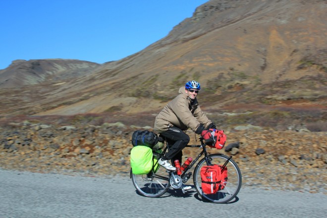
You’re in a great social niche when you tour by bicycle. People are curious enough to want to talk to you, and they are comfortable approaching you. Your mode of transportation makes you non-threatening. It’s part of the magic. I talked with a couple from Leithbridge here. I explained where we were going, and how we went about living on the road.

Thursday

We’re camped at Spruce Creek Campground outside Fairmont Hot Springs. There are many resorts here. I helped Dick, our leader with shopping. We carried the groceries back to the campsite on our bikes. We had deli-style sandwiches and fruit salad for the main course. Sandwiches was plural in both the group and individual senses. ๐Ÿ˜€

The mosquitoes there were fierce. DEET just slowed them down. I had to wear my rain gear to eat. It started raining after dinner, so I wrote my notes sitting in my tent.

Friday

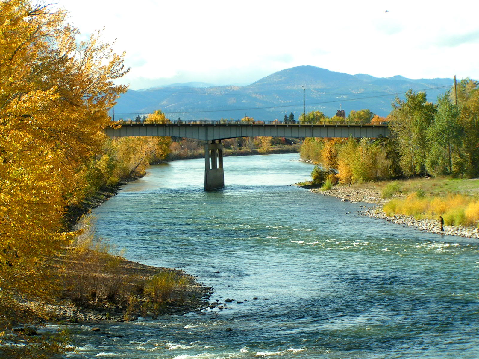
This was a big day for us: 130 kilometers by Canadian reckoning, or 80 miles. Our route was down the Columbia River Valley, which made it mostly downhill until the end.

We rode up to Redstreak Campground when we got to Radium. The camp is up on the flank of Redstreak Mountain. This steep hill at the end of out ride was a bit of a challenge. The big challenge would come the next day.

It was Ed’s and my turn to cook. We made a big salad, and had penne with spaghetti sauce. We also had cookies to stoke ourselves for the ride the next day. The grocery store manager kindly delivered our groceries, which saved climbing that hill twice.

source Kootenay
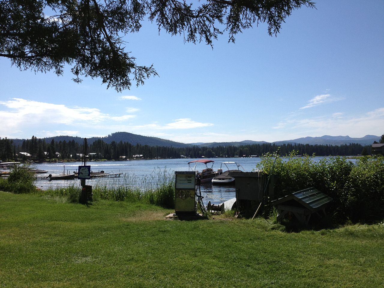
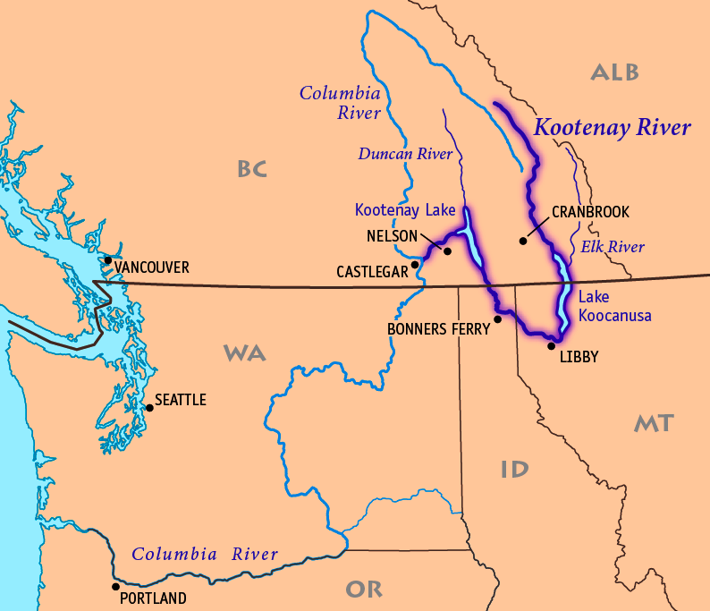
Our route took us past Columbia Lake, which is the source of the Columbia River. It’s only a mile or so from the Kootenay (Flatbow) River here, which flows down to Libbey, Montana. From there it flows back up to join the Columbia in Canada. Just another unlikely artifact left behind by the Continental Ice Sheet.

pool
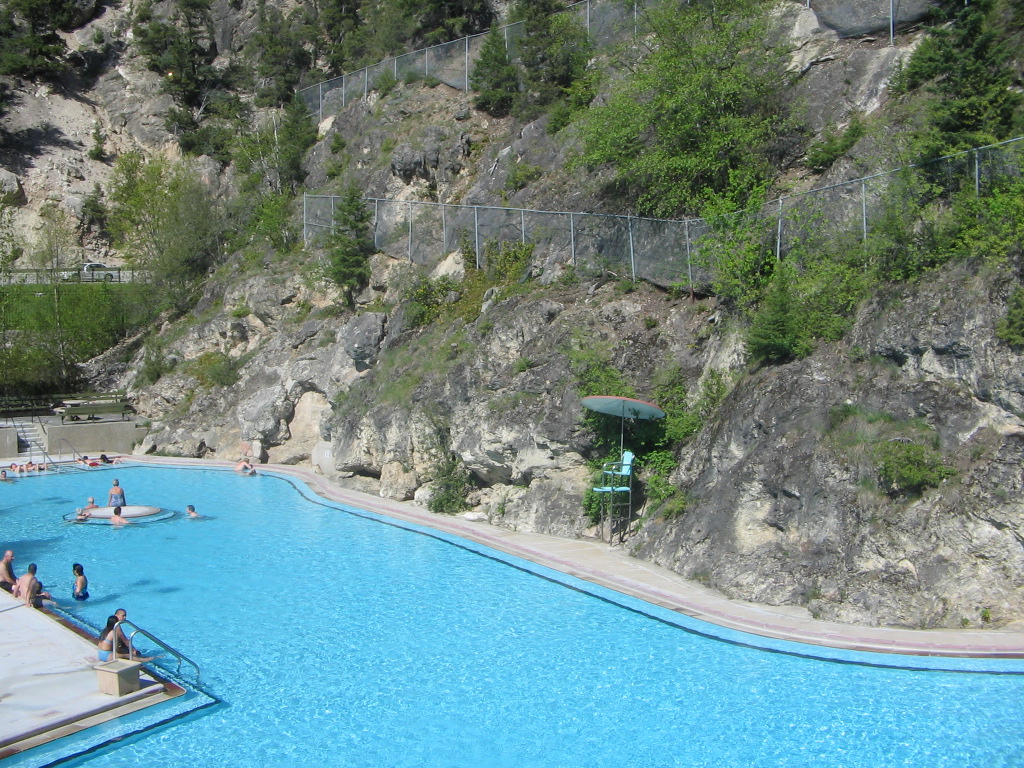
Of course we enjoyed the iconic pools at the featured attraction. They are fed by the hot springs, and the pools feel a like a giant hot tubs. There is little or no radium in the water, but there is radon gas, which a decay product of radium. They have big lockers for your clothes there, and elegant showers. We spent a couple of hours there.

Saturday

11222973_10153634618324703_4594923824943874548_o
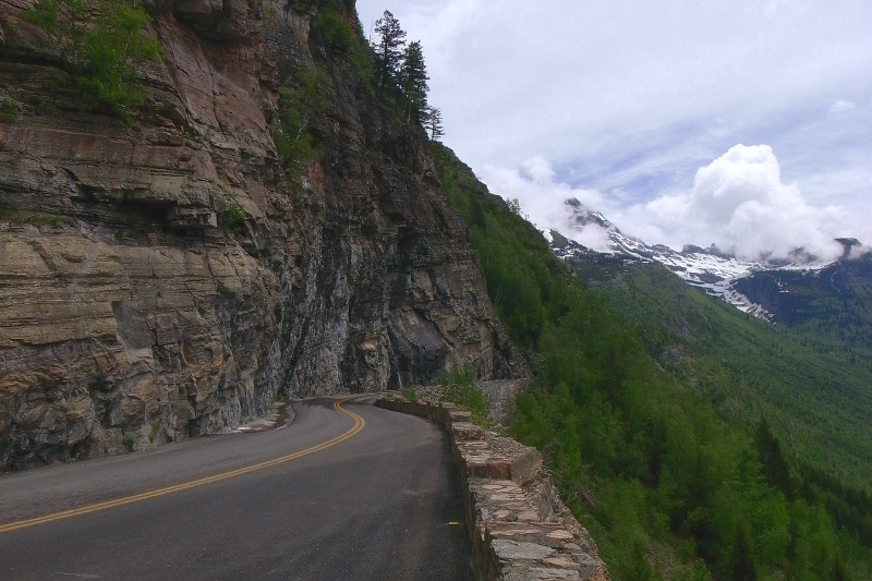
The first thing we encountered in the morning was Sinclair Canyon. There’s an 11% grade right at the start of the climb. Climbing a grade on a loaded-bike is really hard at 8%, so 11% was a struggle. After a mile or so it “leveled out” to 6% or so. I was surprised that everyone made it.

Back over the Rockies again: We’re on our way back over the Great Divide from BC to Banff in Alberta. We’ll soon join the Icefields Parkway, and ride to Jasper. But first we’ll spent some time in Banff. I drove this road in 1985 to go backpacking in Assiniboine Provincial Park.

Sunburst Lake and Mt. Assiniboine

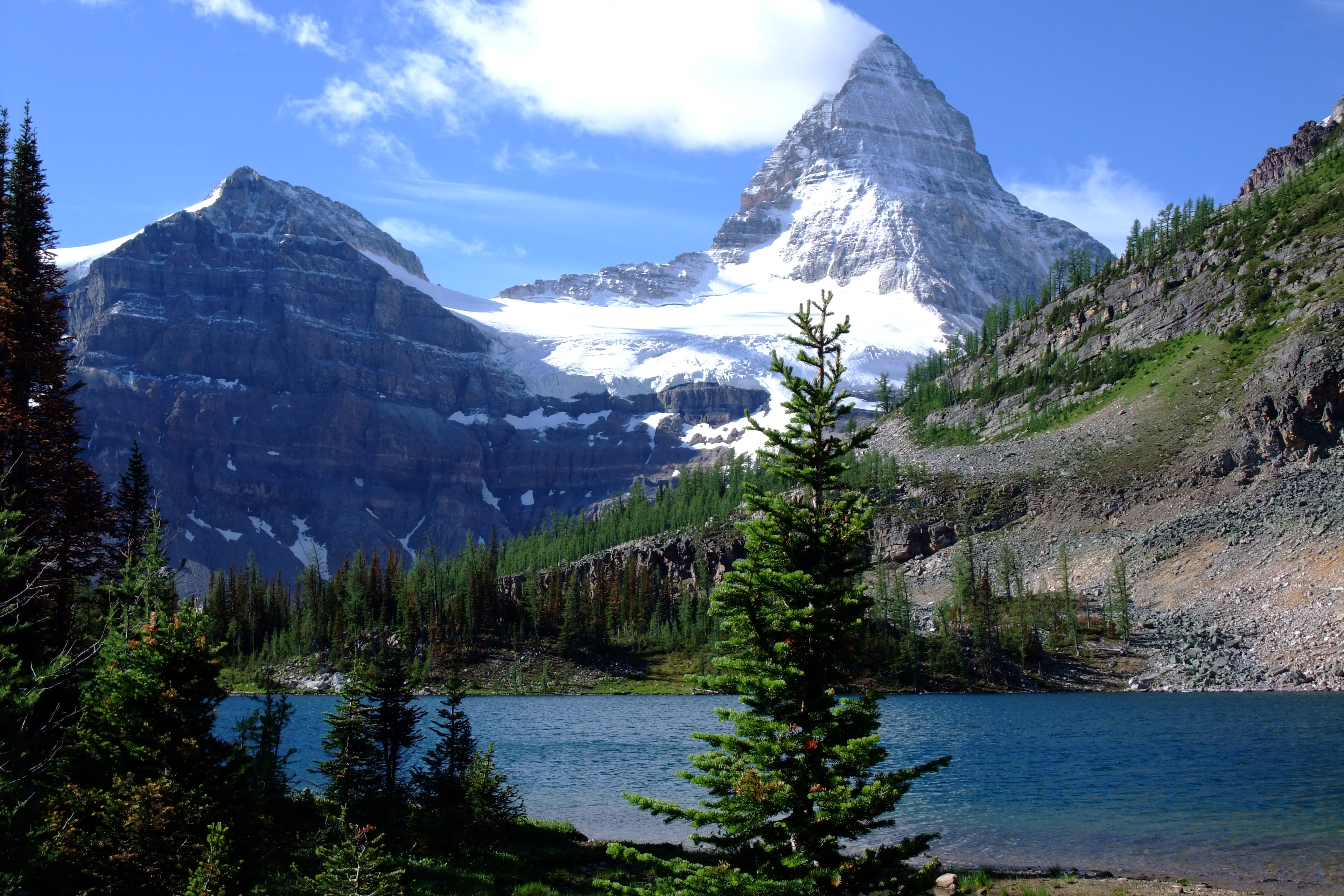
The scenery in Assiniboine Park is spectacular. You cannot climb Mt. Assiniboine without mountaineering gear. Strangely, you can get a helicopter ride into the Park though. I had an uncanny experience when I was backpacking there.

I discovered that it was snowing when I opened my tent flap the first morning there. About two inches had fallen already, so I quickly got on my way. Then it happened. As I walked along the trail I had the illusion that I was walking in place, and the world was rotating under my feet. Delightful. I was able to maintain that perspective for half an hour or so, and then it was gone.

We cycled to Marble Canyon Campground today. It’s near the Continental Divide. Our distance was 88 kilometers, or 55 miles. Tomorrow we’ll be in fabled Banff.

marble
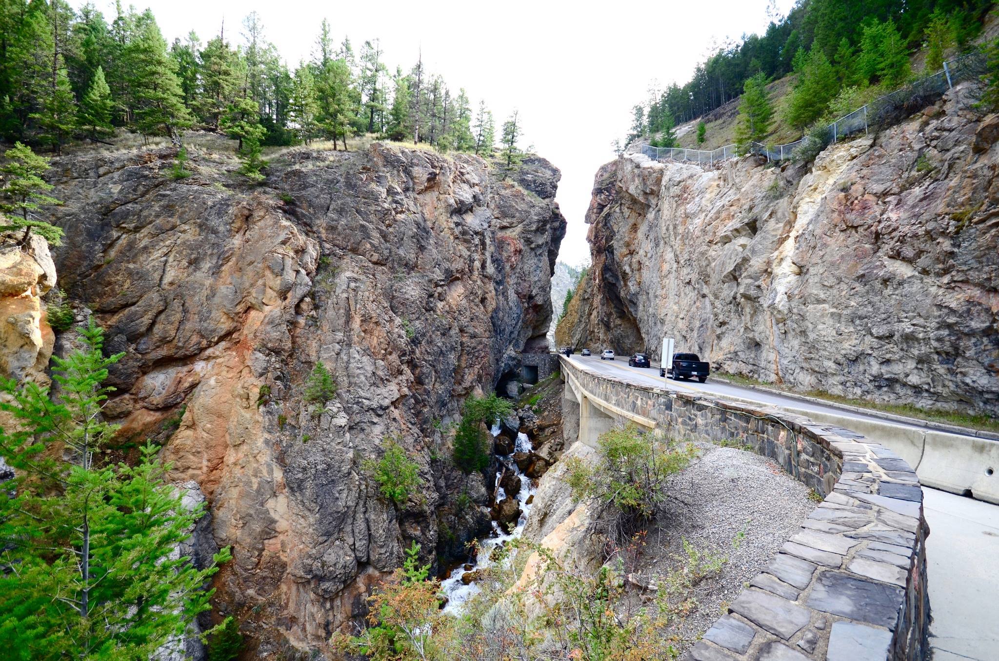
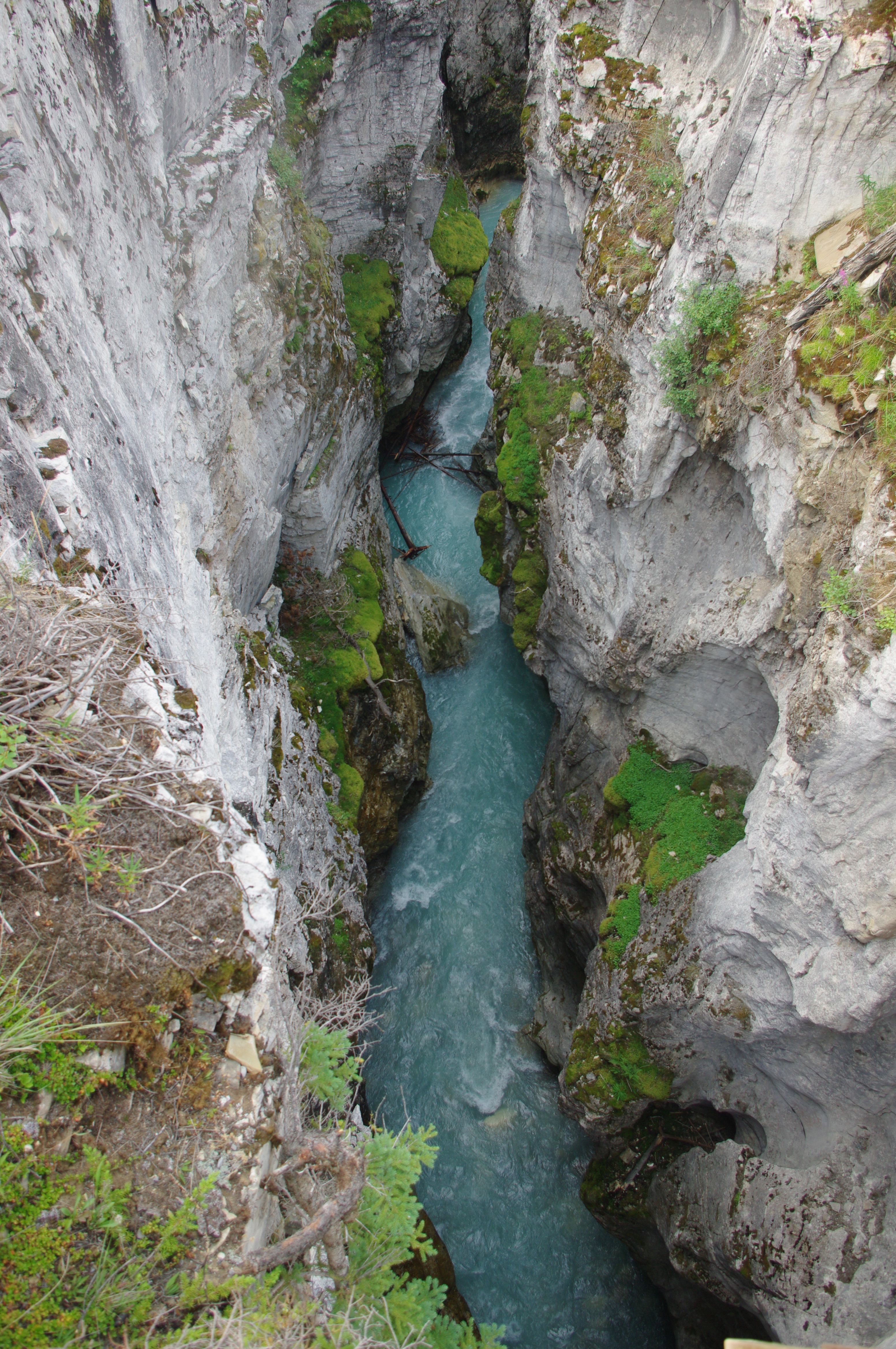
We stopped at nearby Marble Canyon along the way. Think of it as a miniature Grand Canyon. You can access the most picturesque stretch via suspended walkways and bridges over the canyon. It was about 100 feet down to the water. The headwaters of the Kootenay River flow in the canyon. Some of our riders experienced vertigo on the walk, and I have to admit there was a pucker factor up there.

In camp that evening, I talked with the only other (aside from our leader) rider with prior self-supported touring experience. I learned quite a bit about solo touring from him. For example, he carries a faucet handle. Many parks and campgrounds remove them to thwart mischief. But he can get the water he needs, and go on his way.

Touring the Rockies โ€” Three

Saturday

Yesterday it snowed lightly at Logan Pass. We flew down the east side to keep dry; and the storm followed us. When we reached Saint Mary Lake the wind was howling, so we flew on. Today the wind has calmed down.

We left Many Glacier Campground headed for Waterton Lakes today. I’d ridden this road before. It was downhill that direction, and I could make the turns better than cars, so I passed the slower ones. I didn’t pass any going back up today. ๐Ÿ˜€

There was some wind all day, but when we got to Waterton Lakes it became a gale. We gave up on our plan to camp in the park, and rode a few miles north to camp at Waterton Springs Campground. The wind was blowing so hard at first that it blew us uphill without pedaling. The wind was coming at a tricky angle. My Windsurfing experience helped me stay upright.

Prince of Wales Hotel
The Prince of Wales Hotel at Waterton Lakes

In the afternoon we hired a shuttle bus to take us into Waterton Lakes Townsite. It was was strangely nice in in there, with surprisingly little wind. The winds at Waterton are legendary though. The hotel was blown off its foundation during construction. I imagine they used bigger bolts after they got it back in place.

We wandered through the tourist attractions on main street, and then had pizza. After that, some of us hiked to a striking overlook, and on to the Prince of Wales Hotel. We had high tea there, which was quite grand. Then we shuttled back to our campground.

Sunday

Rocks from the collapse of the mountain face at Frank, Alberta
Frank Slide

We rode to Blairmore, Alberta, which is six miles from Crowsnest Pass. That’s near Frank, Alberta, which was nearly wiped out by the mining-induced Frank Side.

pacelineWe faced 20 mph winds on the last 15 miles. We formed two pacelines, which helped, but it was dicey because few of the riders had experience with pacelines. We made it to Blairmore without any crashes though.

Blairmore was big enough to have an IGA (modest grocery store), and we planned to have ย rotisserie chicken for dinner. They didn’t have any left though. According to my notes, we had deli beans, and kaiser roll sandwiches instead. Tomorrow it’s up and over Crowsnest Pass for a day off in Fernie, BC.

Monday & Tuesday

fernieIt was much more pleasant going over Crowsnest Pass than it was in the drizzle two years ago. Fernie used to be a coal mining town, but it’s now a ski mecca. It’s surrounded by peaks of the Rocky Mountains. We camped at a ski resort. My notes say the best feature there was the washrooms. The ground sloped too much, and I kept sliding downhill as I slept.

titanWe had lunch on our way to Fernie in Sparwood, BC. We ate in a park that features the “Biggest Dump Truck” in the world. Sparwood was also a mining town in its heyday. Like Fernie, everything was neat and tidy in Sparwood.

We had breakfast at “Rip & Richard.” I had corned beef hash made from scratch, with brick-oven-baked whole wheat bread. (They could have put in a bit more corned beef, eh?) We also took advantage of the laundromat in town.

basswormMost of us roamed around Fernie for a while after that. We visited a bicycle shop that featured (duh!) mountain bikes. I bought a bassworm (sort of a tubular rubber band) to snug up my rear shifting cable. They even loaned me an allen wrench to install it with. No more fiddling around when changing gears.

Touring the Rockies โ€” Two

“The journey is the destination:” If you’re lucky, that axiom is true for your travels on foot, by bicycle or by ship. That’s why I found bicycle touring so rewarding. That may seem enigmatic unless you’ve experienced it yourself. It’s all about being “in the zone.”

The day’s routine is part of the magic of touring, but a detailed record of each day is probably of little interest for most readers. I included bits and pieces of that in the previous post. I’m going to describe the typical day now. From here on, I’ll write about just the highlights of this tour. I hope that makes the rest of these posts less plodding.

The daily cycle (pun intended) on tour

I consider Tevaยฎ (velcro) sandals an essential piece of personal gear if you use “clip-in” shoes for riding, which you should. You’ll need the sandles when in camp. They’re particularly nice for showering in the rustic accommodations you’ll encounter.

Your day starts when you get out of your sleeping bag. Once you’ve dressed, it’s time for breakfast. That can be cold, or something you cook, depending on circumstance or impulse. After cleaned up your kitchen, it’s time to start packing things up. You’ll probably want to don your riding clothes first to save changing later. Fill your water bottles at this point too.

loading
Unknown tourist on an unknown road. ๐Ÿ˜‰

General rule for loading a bike: Put your small, heavy items in the front panniers, and bulky items in the rear ones. Things you’ll need ready access to โ€”ย  map, camera, sun glasses, etc. โ€”ย  go in your handlebar bag. Your tent and sleeping bag go on top of the rear rack. One last look at your map, and off you go.

This sequence is simple when it’s dry. It’s more interesting when it’s raining. Unless you can get under a roof or tarp, you’ll need to pack everything while you’re inside your tent. Finally, pack up your tent, load it on the bike, and off you go. You did bring proper rain gear, didn’t you? (I packed this way at Prince Rupert, BC during a veritable downpour)

Whether you’re alone or with a group, getting more food is a daily task. Food may be available at the next destination, or you may be able to buy it on the road. It’s best to carry some emergency rations as well. Lunch is usually something cold. I liked to plan my rides so I could stop at a restaurant for brunch too.

It’s usually best to set up your tent soon after your arrive at your next camping spot. It may be at a campground, or somewhere off the road and out of sight (just lift your bike over the fence and go into the woods). Once your tent is set up, you can unpack for easy access to your clothes, personal items, books, etc. You may also need to escape in from mosquitoes or black flies in there too.

The rest of your day is (mostly) free time. You’ll want to inspect your bike, fix any problems, and lube the chain at some point. Then you can hike, read, swim, take pictures, write in your journal, etc. I found I’d rather spend more time on the road, and less time in camp though. You can easily ride eight hours or more a day if you’re in proper shape, and keep eating on the way. You’ll likely have a smartphone too, although I recommend you consider yourself off the grid.

Dinner always seems well earned. Clean up your kitchen when you’ve finished, and be sure your food is where the bears can’t get it. The day is done when you close your tent flap and slip into your sleeping bag. You’ll know you’re having fun when your tent begins to feel like home.

Touring the Rockies โ€” One

That's not me, but it shows a fully-loaded bike like mine.
That’s not me, but it shows a fully-loaded bike like mine.

I explored other versions of bicycle touring between Cycle America adventures. The concept/challenge of self-contained tours appealed to me. I learned that Adventure Cycling offered self-contained tours. There are no support vehicles, and you carry everything on your bikes. The group buys food along the way, and each rider packs part of the kitchen gear. The leader is there to show you the ropes. How could I resist?

I signed up for an Adventure Cycling tour in 1996. It was a “self-contained” tour โ€” meaning you carry your water, food, tent, sleeping bag, rain gear, street clothes, and other personal items. I also needed a way to load all that gear on my bike. I outfitted my beloved Bridgestone with touring accessories, and was all set for “fully-loaded” touring.

Missoula to Jasper
Our tour route was Missoula, Whitefish, Fernie, and Banff to Jasper

Marcia, Barb and I drove to Missoula, Montana for the start of my “Great Parks North” tour. My notes for this tour helped me remember some of the details. We had lunch at the Red Lion Hotel when we got there. Then we went to Birchwood Hostel where the tour members were spending the night. That was the first and only time I stayed in a hostel.

That evening, most of the riders walked downtown to see what was happening at the outdoor “Big Band Dance.” The only thing I really remember was the beaver we saw on the way. It was swimming in an irrigation canal that runs through town, and was about the size of a big dog.

Confluence of the Bitterroot with Clark Fork

The next day our group went on a shakedown ride in the area around Missoula. We rode over the Bitterroot River, down to Clark Fork and back to town — about 20 miles. I found that I needed to adjust my bike’s derailleur so the gears would shift smoothly (more about that later). I’m sure others had problems to solve too.

The Clark Fork (of the Columbia River) flows from west of Butte, Montana to Lake Pond Oreille in Idaho. If Lewis and Clark had gone down the Bitterroot to Clark Fork, and then northwest they could have canoed through the mountains instead of making a desperate climb over Lolo Pass.

Monday

Seeley Lake in the Swan River Valley.

We rode up the Blackfoot river, and then north to Seely Lake the first day. Dick, our leader, had already ridden the whole tour up and back. He had a safe route for us to take out of Missoula. The rest of the ride was easy. My notes tell me that it got hot in the afternoon, and that I drank two quarts of Power Aid.

We camped at Seeley Lake instead of the high school in town on this tour. We had rice and stir-fry vegetables for dinner.

I had trouble setting up my tent this first night. I had forgotten that the poles crossed over at each end before they attached to the tent. Dennis (whoever that was – the notes don’t say) helped me figure that out.

This tour covered 750 miles in 17 riding days, or about 45 miles per day. That’s an easy pace, even in the mountains, but not all of the riders were ready for more mileage than that. It gave us plenty of time to enjoy the highlights along the way.

Tuesday

Granola and yogurt for breakfast. We probably had coffee and fruit too. This part of the tour reversed the Swan River Valley segment of the tour route last year.

It was hot at Swan Lake, and our campsite was out in the sun. I hung out at the gazebo down by the lake. The water was cold, but many of us went for a swim anyway. One of the things that’s always on your mind on a tour is when do we get something to eat. I don’t remember what we had for lunch, but we had spaghetti for dinner.

The road was under construction this year. We had to wait just like cars several times, but sometimes they let us go on ahead. Our narrow road tires made it difficult at times in the loose dirt.

Wednesday

We took a gravel road to bypass Big Fork this time. That way we avoided some heavy traffic on a narrow road. One of our riders had a front cone (part of the hub bearing) fail out there. We put a lot of grease in the hub, and hoped for the best. She did make it. I made a note to carry spares for critical parts on future tours.

According to my notes, we had a “fabulous” lunch at a convenience store. Then we took the old Columbia Falls Stage Road to bypass another long stretch of heavy traffic. We camped near the town of West Glacier, and spent some tourist time there.

Thursday & Friday

Lodge at Lake McDonald in Glacier National Park

We had a lazy day on Thursday. We rode about ten miles to Lake McDonald Lodge in the morning. It’s a rustic old place that used to be a big tourist stop. We bought our lunch there. I did some reading, and strolled down to the lake.

Classic red tour bus at Glacier Lodge

The Lodge is also the starting point for bus tours up to Logan Pass. The buses are carefully maintained originals. Replacements would not work well on the narrow road over the Pass.

Later in the afternoon we rode up to Avalanche Campground to be close to the start of Going to the Sun road over Logan Pass. Cycling is prohibited between 11 am and 4 pm, so we needed to be close to the start, and get going early.

The ride over Logan Pass is not hard, but you need to keep moving. You’re raising 250 pounds or so up 3,300 feet from the start. It’s a narrow road, so you need good bike handling skills too. Loaded bikes are more stable, which helps, but you can’t afford to make mistakes on that road.

Going to the Sun road.

The scenery is majestic: Tall rugged mountains, big lakes, fast flowing streams, unique waterfalls, mountain goats, etc. It’s too much to take in. The mountains here were formed by erosion after a 5,000 foot thick chunk of rock was thrust 35 miles to the east over the original crust.

We sailed down the east side of the pass, and rode up to Many Glacier campground. We didn’t see any glaciers because you need to hike some distance to see them. None of us were eager to do that after a 60 mile day with more than 3,000 feet of climbing. We’ll get to Canada in the next post.