8. AK, BC & YT — Tanana River

The Tanana River watershed is about 500 miles long. It originates near the Yukon border and ends at the Yukon River. The Tanana flows across a wide flat plain in the center of that watershed. It is 200 miles from Fairbanks from Tok, and the highway generally follows the Tanana River from Tok to Fairbanks. That would be my route for the next four days.

It gets hot in the summer in that part of Alaska, and cyclists need lots of water. There are many streams flowing from a range of mountains to the south, and I assumed it would be easy to find water as I went. That turned out to be true, but the streams were all chocolate colored.

Chocolate water is not like chocolate milk. The streams ran across mud flats and were all loaded with silt. I had a way to filter out silt, but it would have been a lot of trouble to cross the mud flats. So once again I was carrying a lot of water. Good thing the road was relatively flat (but boring) the whole way.

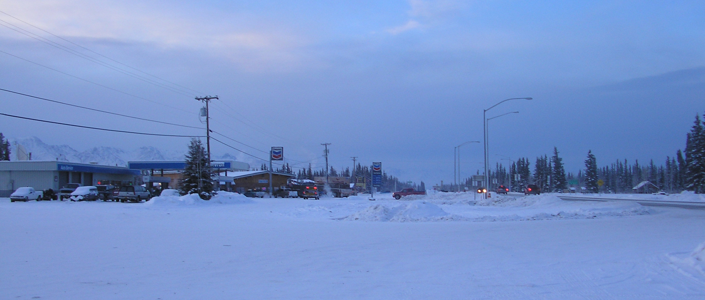
Dot Lake was my first stop on the ride to Fairbanks, and I had an interesting time there. There was a lodge with tent sites there. I had dinner there and paid for camping. The instructions were, “Go past the sled dogs and turn left. You’ll find some spots where you can pitch your tent.”

Another cyclist was cooking some food at a picnic table when I came out of the lodge. He had started at the tip of South America and ridden up to Inuvik. That’s way beyond Fort McPherson where I had considered riding and almost to the Artic Ocean.

He was on his up way beyond the Artic Circle here in Alaska. It had taken him two years to get to Alaska, and he told me he had been touring for five years total. He was very talkative, and I asked him how many times he had to change his bicycle chain. He said, “Never,” and then explained.

Chains “stretch” (grow longer as they wear). If you don’t replace them frequently your cogs wear to match them. Then a new chain won’t mesh right with the old cogs. He told me he never changes his chain. He just buys a new set of cogs and a new chain when they are both worn out. That costs less in the long run.

A dozen or so dogs barked at me as I rode out to find a campsite. They sounded fierce but probably were friendly. There was a nice flat spot for my tent, but all the trees had short limbs. There was no way to hang food so that it was far enough from the trunk to be out of the reach of bears.

Necessity is the mother of invention: I came up with a way to use the same line for hoisting the food to also pull it away from the trunk. It was a simple but not obvious solution. I won’t describe it here, but I wish I had figured that out years ago for backpacking. It took a minute to understand the sketch in my journal.

The next stop was Delta Junction. Must not have been all that memorable. I have one journal note and no memories of it. I realized the 4th of July weekend was coming and the next stop would be close to Fairbanks and Eielson Air Force Base. I decided to stay at Midway Lodge the next night to avoid the campground rush that the weekend would bring. There was no internet in those days, but finding places to stay was what my pages from Milestone were for.

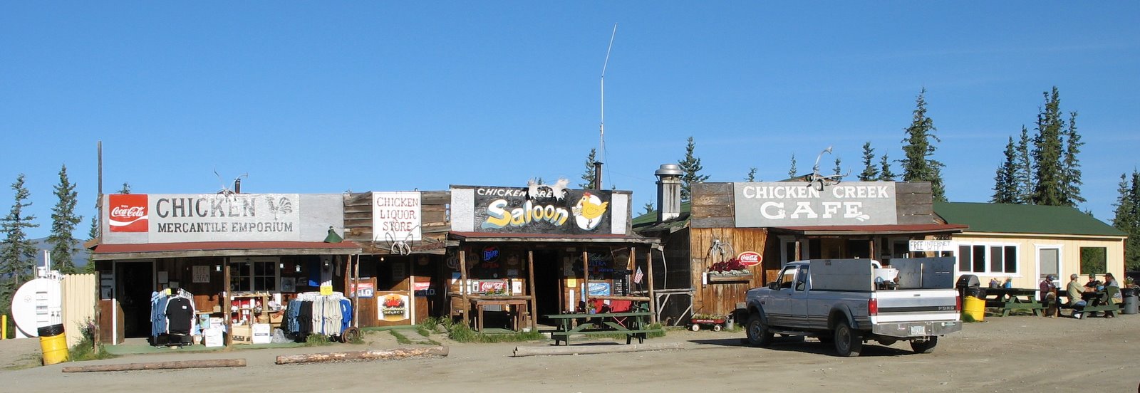
The Midway Lodge was a typical Alaskan place, i.e., it was rustic and the bathroom was down the hall. After getting my bike and gear up to my room, I took a shower went down to the lounge to watch TV and have a beer. There was nobody else there. A talkative cuss, clearly with opinions of his own, came in. We had a good time exchanging observations and he told me about breaking through the ice when he was out patrolling the big oil pipeline.

Everything is casual in a place like this in Alaska. A group of women came in and I talked with them for a while. Then I had a hamburger steak and went up to my room to read my book. Breakfast was at 7:00 am, and I’d be in Fairbanks early in the next day.

It was a quiet Sunday morning when I arrived in Fairbanks. I sailed right through town on the Old Richardson Highway and pulled into Chena River Wayside Campground. It’s a pleasant, quiet place. A dozen or so “Bikers for Jesus” were there with their little camp trailers behind their motorcycles. One couple showed me how their trailer works.

One couple showed me how their trailer worked. Two bunks swing out to the sides. That leaves a short hallway in the middle where you put a mat to stand on. A canvas skirt covers the sides and back. Now you have a place to change clothes. Home away from home.

I explored Fairbanks the next day…

7. AK, BC & YT — Tok: Crossroad

July 1, 1997: My journal says I camped at the Gateway Salmon Bake. I remembered it as Tok Salmon Bake, but nevermind. Even if you take the Top of the World Highway, you have to go through Tok to get anywhere in Alaska by road.  It’s the only town of any size on the 385-mile haul from Whitehorse. Three roads enter the interior from Tok: One to Fairbanks, one to Anchorage and one to Valdez. As an aside, I’ve ridden about 30% of the paved highway miles in Alaska.

I had halibut instead of salmon for dinner the first night there. It was the best I’ve ever eaten. (Better than Dave’s for those who’ve been there.) I decided to spend another day in Tok for a break, some shopping, and some salmon. I camped near the showers (my journal says it was $5, not free), and right next to a new shower shed under construction.

Buildings in Alaska reflect local realities. There aren’t many carpenters, plumbers, sheetrockers, masons, and other tradesmen in outlying locations. So local, but untrained people improvise much of the building. They kind of do it by eye instead of from plans. Old buildings like those in Chicken were built that way, and this one at the Salmon Bake was being built that way too.

I met a cyclist here who I think was from Germany. He started in LA and rode to Bellingham to take the ferry to Haines. He is going back via Jasper and Montana. Roughly the reverse of a tour I had hoped to ride one day. I also met three girls doing the Haines to Dawson City to Skagway loop. All roads lead to Tok.

I was sleeping in, but I heard it starting to rain the next morning. I got up quickly and hurried over to Fast Eddy’s restaurant before it got too bad. I had eggs and reindeer sausage for breakfast (sorry Rudolph, that’s big up here). There was nothing unusual about the taste. The restaurant is surprisingly nice. Tok reminds me of an iconic Route 66 town in Arizona or New Mexico. It’s a busy, rustic place with lots of traffic.

I did some planning and grocery shopping on my day off. I bought some gold nugget earrings for Marcia and some small gifts for Barb, Nick, and Missy. Then I made reservations for the train from Fairbanks to Denali National Park, and on to Anchorage. The fare was $184, including $20 (twice) for my bicycle. I thought the ride would be interesting.

I got trapped one time in a gravel ridge on a descent North of Spokane. Once you are in one you can’t steer out of it safely. I lowered the air pressure in my tires for the gravel road from Dawson City. Lower air pressure gives you better control. There were some steep, gravelly descents to worry about on the way. I pumped the tires up again here in Tok so they would roll easier of the pavement. I also got everything packed for a quick start in the morning because it was going to be a hot day.

I had a big chunk of salmon for dinner the second night. Delicious. The owner owned a commercial fishing boat before. He told me his old contacts kept him supplied with the best fresh fish. Quite a few people ate at the salmon bake. It wasn’t baked though — they cooked over charcoal in a long fire pit. Their “Alaska Baked Beans” were very good too.

I got up at 5:15 am in the morning, ate breakfast at Fast Eddy’s, and was on my way to Dot Lake. I arrived there at 11:00 am, long before it got too hot.


6. AK, BC & YT — Chicken, Alaska

My ride from the border was mostly downhill on a curvy road. There was recent maintenance, but there was ample evidence it’s often deeply rutted. There are trees that shade and keep it damp. so that’s not surprising. Although it is called the Taylor Highway in Alaska, it may have been what Bob Broughton referred to as “…bad road.”

I only went to Walker Fork Campground, 30 miles away, because the day before was a hard ride. It also fit in with the distance to the next stop halfway between there and Tok (pronounced Toke).

The campground hosts were helpful and interesting. They were from Anchorage, but they came up there for the short camping season each year, and then went to Arizona/New Mexico/Texas “when the white stuff starts to fly.” They knew where Happy Trails is too.

This campground is in the historic Fortymile Mining District. Gold mining started here before the Klondike gold rush. I saw an old dredge on the side of the road here. It was about one-fourth the size of the one on Klondike Creek. There is still active mining in  Chicken, the only “town” in the 185 mile stretch between Dawson City and Tok.

It rained quite a bit shortly after I got my tent up (in a hurry), and then drizzled on and off for the rest to the day. A strong shower in the evening ended the rain. The rain kept me “indoors” much of the afternoon, and gave me time to organize my gear, look at my maps, plan my stops and review logistics for the next couple of days. It was nice to take a break in my cozy tent for a change.

My destination for the day was West Fork Campground. I got to Chicken about noon. Chicken is the remnant of the Fortymile gold mining activity. The population is 7, which swells to 17 in the summer. Small world thing: Our Vancouver friends know the Mayor of Chicken. He comes to Scottsdale, AZ in the winter and works a small gold claim in Chicken in the summer.

Chicken is an unlikely name for a town. There were many ptarmigan (a member of the grouse family) in that area. The founders wanted to name the town after them. There were competing ideas about how to spell ptarmigan though, and they didn’t want to embarrass themselves by getting it wrong. One of them said a grouse was sort of a chicken so why not name it Chicken? They all agreed. (There’s also a Joe, Montana, which I’ve also cycled to but that involved a name change.)

Downtown Chicken consisted of three old buildings — restaurant, bar, and curio shop. (A fourth one that detracts from the charm of the place was added later.) I had soup and a sandwich at the restaurant and bought a book and some power bars in the curio shop. Tisha: The Story of a Young Teacher in the Alaska Wilderness is about life in Chicken in the old days. I read it on the rest of my tour. Et was good entertainment.

I expected to have an easy ride to West Fork Campground, but it was a long pull uphill out of Chicken on a hot day. I drank all my water by the time I got there. The campground was hot and dry too. I went down to the river to get water as soon as I got there. After a cool drink, I set up my Tent in a choice campsite. Then I fixed lots to eat, including pasta and salmon (must have been from a can). I could have gotten a job there as campground host too. They offered $22 per day, with ten days on and four off.

I camped close to a little pond with eight or more ducks on it. If I remember, they were mallards. They started a ruckus after a while for no reason that I could discern. Maybe they were fighting over a girlfriend.

The next morning I thought I heard the ducks going at it again. But I didn’t see the ducks. So I went back to finish breakfast, and as I was eating I heard a Moose snort at me. I looked across the pond and there he was. I could barely make him out. He was standing behind some bushes looking back at me. Just curious I guess.

I didn’t fill my water containers when I left for Tok. I filled them at Logging Cabin Creek. It was six miles up the road, and there was quite a grade leaving the campground. No point in hauling water uphill. I took enough at the creek to make it to Tok. I wouldn’t have needed that much, though. Water was available off and on most of the way.

By the time I reached the halfway point in my ride a thunderstorm had formed behind me. It was moving my way. The road was on a ridge and the lightning worried me. I rode ten or fifteen miles as hard as I could as it chased me. It finally gave up faded away. I did get wet, but that was OK, as it was a hot day.

It was 60 miles from the campground to Tok. I was glad to stop. I was getting a cramp in the calf of one leg, and I wouldn’t have been able to go on much further. I spotted a sign for the Tok Salmon Bake that offered free camping if you ate dinner there. How could I go wrong? I soon had my tent pitched, took a free shower and was ready for some Salmon.

[photos (in reverse order from the direction of my ride)]

5. AK, BC & YT — Top of the World

Top of the World Highway” — what an enticing boast. This was the big ride I’d been eager to attack. The name has an magnetic attraction like “Going to the Sun Highway” does. (That’s a supposedly formidable road over the mountains at Glacier National Park. I’ve ridden over that one both ways. It’s tricky in a car, but not hard on the right bicycle.)

The little George Black ferry took me across the Yukon River to the start of what was then a gravel road to Alaska. I was hoping the relatively dry summer had left Top of the World in good condition but Bob Broughton’s description was still in the back of in mind.

“It is unpaved, often soft, and when wet becomes impassable. It is also very hilly. Bad road!”

Here’s how the ride went: It was a killer, only because I did it in one day. The road was good, but there are a never ending series of hills to climb. I was glad to find the first three miles, which I’d heard were covered with 2″ gravel, now covered with soil and smaller gravel. The first hill was the biggest one. It took me two hours to climb from the ferry up to the “top of the world.” There was also a long, steep hill just before the border. It ruined my vision of just cruising to the crossing.

You can see for maybe 100 miles in all directions from various spots up on top. The terrain is big, rounded hills covered with tundra. They fall away toward the Yukon River to the north and east, and there are big mountains to the south and west. You got a first-hand feel up there for how big Yukon and Alaska are.

I was carrying more than a gallon of water and food for four days, so my load wasn’t light. It was 70 miles to the border, and I hoped to go a bit beyond that. Turned out I wouldn’t have needed all that water. I found a spring by the side of the road at just the right spot, but I never regret not needing to use my insurance.

The advisory signs for the Alaska border crossing at the start of the ride were confusing. There was no clue if the border closed on Alaska or Yukon time, or whether it was Daylight Saving Time or not. I guessed it was Alaska time and rode hard all day but ended up getting there half an hour too late. [border photos]

I didn’t want to camp right there at the border, so I went back up the road aways. I learned something new about tundra when I went to set up my tent. There are clouds of mosquitos in it.

I’d eaten right on the side of the road, but I wanted to get off on the tundra for the night. I ended up not even using the poles for my tent. You can’t do that and swat mosquitoes at the same time. I crawled into my tent and zipped the mosquito netting behind me as quick as I could.

I went back to the road for breakfast in the morning. The mosquitoes were too cold to fly, but I needed a flat spot for cooking (tundra is thick, soft and lumpy). There were a dozen motorhomes waiting to cross the border, and I got in line behind them after loading my bike again.  When it was 8:00 am, the agent came back to where I was and told me to go to the front of the line. Great.

Jeff, the agent, looked at my passport and asked some customs questions. He wanted to know if I liked gourmet coffee. I wondered if that was a trick question, but I said yes. He invited me to wait on the porch of the customs building, and told me he would brew some when he finished with the traffic. “That way the dust from the motorhomes will settle before you start off,” he said. (It also meant they wouldn’t all be passing me one at a time.)

I went up on the porch and waited for Jeff to finish. The building was built with real notched logs. The coffee was very good. I didn’t think to ask him if he had roasted the beans that morning, though. We talked quite a while about how great it was to be up there. He and his wife were only there a few months a year, because the road closes in the fall.

Jeff had several stories about other cyclists, and one about a fellow who rode there from South America on a horse. Actually it took four horses and six years for him to get there. Then he took my picture (using my camera and ill-fated film). I stood in front of a sigh that said “Most Northerly Border Crossing into the US.”

I had a feeling Jeff followed a similar routine on many mornings. I said thanks and goodbye, and was off down the road to lower terrain. The name changes to Tailor Highway in Alaska, but some people consider it to be part of the Top of the World Highway.

[more photos] [Milepost] [video]