Grand Coolee is an interesting artifact left behind by the Missoula Floods that the Cordilleran unleashed. It is a large gash the floods eroded in solid basalt. It came within a mile of diverting the Columbia River permanently.
Grand Coolee Dam was built in the canyon of the Columbia River, but was named after that artifact. The town of Coolee City is built on the narrow strip that was left between the Columbia and the Grand Coolee.
Switch the map to “Earth/Satellite View” for better perspective.
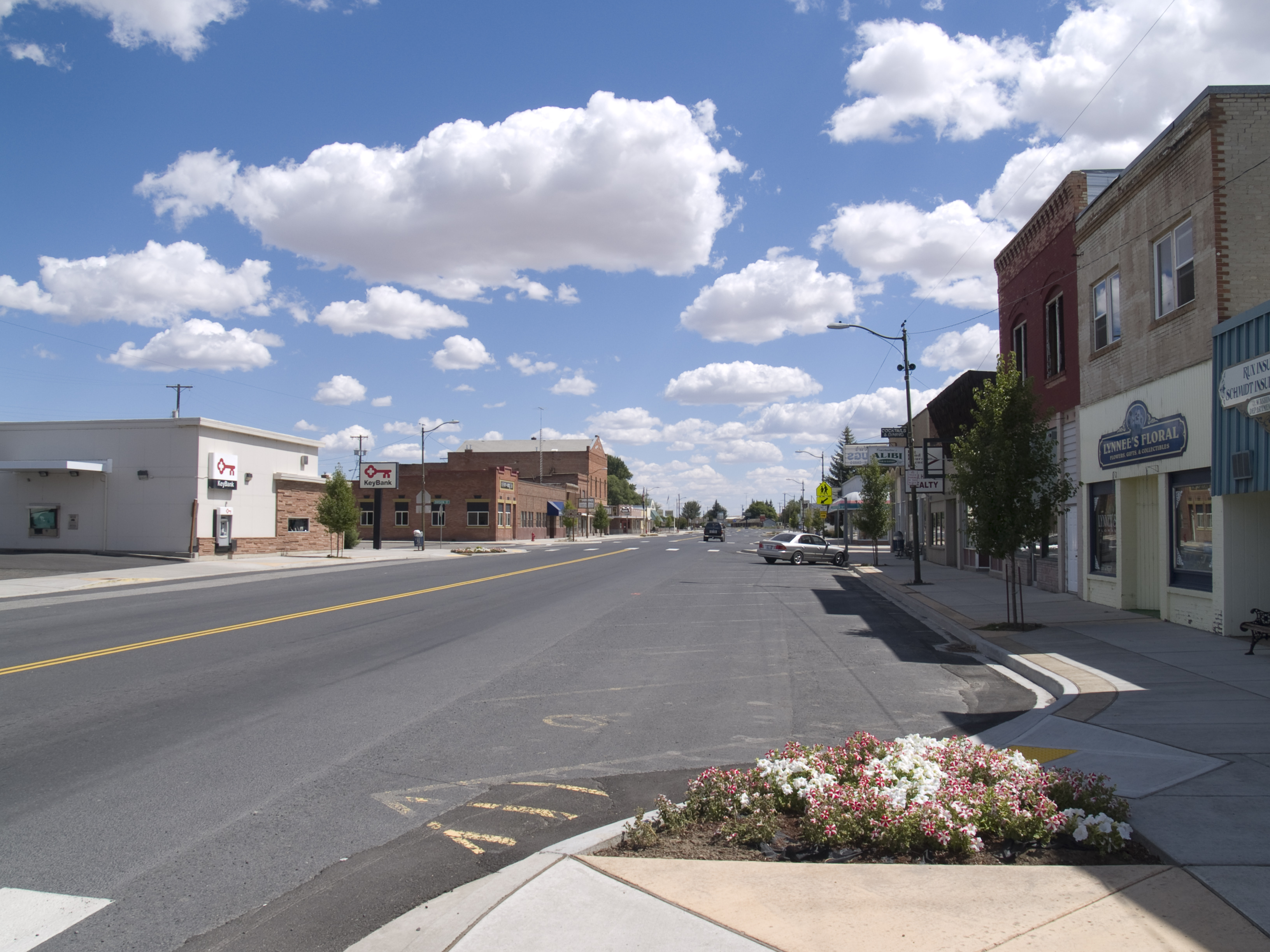
My destination today is the little town of Wilbur. I’m beginning to feel like a horse that smells the barn (like our pony when I was a boy). It will be a tough ride, but I’m lighter and stronger than I’ve been in years. I could have split the ride into two days, but this was familiar country that didn’t hold much intrigue. Besides, I hope to be home tomorrow.
Bridgeport and the plateau to reach on beyond.
The ride started with a climb up to the Watertown Plateau from Bridgeport in the Columbia River valley. This country is nearly empty. It’s the kind of place where the miles just slide by if you let yourself get “in the zone.” Eventually I was looking at the Columbia River from a high vantage point above Grand Coulee, and soon I was coasting down to the town.
I knew the climb back up from Grand Coulee to the plateau was going to be tough, so I used my glycogen window to prepare. (The idea is that sugars readily convert to glycogen in your muscles during the half-hour after strenuous exercise.) I ate a bunch of figs, the cyclist’s friend, just before the long coast down to Grand Coulee. I also drank plenty of water. I bought a quart of orange juice (one of the very few juices you can buy that is 100% fruit juice) when I got to the grocery store. I would drink it with water on the way (diluting it is another cyclist’s trick). It was a hot day, but now I felt ready to face the climb ahead and the rolling hills on the way to Wilbur.
It seemed my strategy worked. I felt strong all the way up the grade. The only problem was the heat. There was a light tailwind blowing up the grade. Because I was going slow in the same direction, I didn’t have the usual bicyclist’s advantage of air cooling. I had to stop every 100 yards or so to let the slight breeze cool me off. The situation was similar to my earlier encounter with black flies at Burns Lake, but I was spared the bites. By the time I got to the top, the breeze turned into a headwind, and I cooled off nicely.
From everydot.com
The campground in Wilbur was nice, the showers were clean, and it only cost $4.00 for the night. I had a grassy area under some shade trees all to myself. It was a short walk in to town, so I celebrated my arrival with a steak dinner. There was a downside though. By the time I got back to camp, hay fever caught up with me.
Sunday, June 29, 1997
I started the day with breakfast in Wilbur. Nothing like some good greasy food to get you going. 😀 Then I headed for Spokane. As I rode along, I thought about my experiences on the tour. One aspect was how my perspective changed as I went along. After Bob went on ahead, it felt like I was just starting out on my real journey. Later on it dawned on me that in a sense I was totally dependent on my bicycle and my body to get me through. And when I woke up one morning, I realized that my tent had become the place I lived.
Navigating through Spokane on a loaded bike was not the same as just riding around downtown. I picked a route with a minimum of traffic and climbing, but there were many stops, which are more tedious with all the weight. I even got slightly off track at one tricky point in the route. At the end, when I reached the hill to our house, I had to push the bike up the steepest spots. I didn’t need to do that anywhere else on the tour.
And there I was, a month and 1,985 miles later. Aside from Marcia’s greeting and a residual glow from the tour, it was like I never left home. And I had big ideas about more tours I wanted to take. I also knew what changes in gear I needed to make.
Postscript: I don’t think any of the cyclists bound for Alaska told me how they were getting there from where we met. There’s some good information on that question in Bob Broughton’s FAQ. I like his first answer best.
Q: How long will it take to bicycle up the coast from Vancouver to Alaska?
A: It depends on how long it takes to build the road. 🙂
(The cyclist who planned to go to Terra del Fuego came down from Alaska on the Cassiar Highway, which I hoped to ride someday too.)
I landed in Anacortes around 3:00 pm. It was only 18 miles to Bayview State Park from there. I followed an Adventure Cycling map, which makes it easy to find backroads. The park was well kept, and there was a grassy picnic area right on Puget Sound.
They even provide firewood, but I only needed a ounce or so of stove fuel. I was now looking west across the sound instead of east. Tomorrow I’ll ride along the Skagit River into the North Cascades.
I got up early in the morning for the long ride to North Cascades National Park. I stopped for a second breakfast when I got to Sedro-Woolley. I walked right in and sat at the counter. I soon realized that I had picked a one-star cafe, complete with denizens of the night.
They were very curious, and the food was very good. Then I rode over the Skagit River to take a backroad instead of going up Highway 20. It was a long, lonely stretch, with virtually no traffic. I did need to stop under big trees from time to time to keep out of rain showers.
That road ended near a small town called Concrete (probably where they made concrete for the dams ahead). I crossed over the Skagit again, and was on Highway 20. The road was still relatively flat up to the National Park.
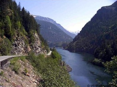
The campground was small for a National Park, but many times the size of all the other camps I had stopped at. I particularly enjoyed the huge trees there. From here on it’s all uphill until I make it over Washington Pass at 5,477 feet. Then it’s down 1,000 feet, and back up to 4,875 feet at Rainy pass.
The climb over Washington and Rainy passes was challenging. I was trying to stay ahead of the rain, which chased me all the way to the top. It took six hours. I did get a few sprinkles, but stayed dry.
Of course it was dry on the other side, and I coasted down it for 10 miles at about 25 mph. I planned to camp in Wintrop, which was 20 easy miles further on. When I got there I discovered it was completely occupied by a motorcycle rally. They invited me to squeeze in, but it was only a few miles to Twisp, so I continued on.
There is a KOA campground in Twisp on the Methow River. It was surprisingly well kept. I met three or four guys there who were riding from Sedro-Woolley to Lake Chelan. They were not carrying much gear.
They left a while after I did in the morning, and passed me on the way to Pateros, on the Columbia River. A little while later I passed them. They were taking a break even though it was slightly downhill all the way.
This pattern continued until we parted at the Columbia River. They were surprised that even though I was on a loaded bike, I was keeping up with them. Each time we met they had more questions. They wanted to know how far I had gone, how old I was, etc. One of the fellows always responded, “Awesome,” each time I answered.
I’m sure they got to Chelan. I’ve ridden that stretch of the river up and back many times, including the climb up to Chelan. They only had to go one way.
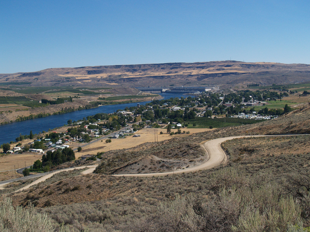
I went on to the campground at Bridgeport. It’s between town and the south bank of the Columbia River, which was flowing strongly — much like the Skeena River when I saw it.
Tomorrow I have another challenge. I’ll drop down to Grand Coulee, and then I face a long climb back up from the Columbia River to Wartertown Plateau. I’m dead certain it won’t be raining though. And I don’t need “no stinkin’ maps” to get home from here.
My plan for the first leg of my ride down Vancouver Island: “Go to the Downtown Campground in Port McNeill, then to the Fisherbay Campground near Sayward the next day. The Coral Reef Pub is 5 kilometers from the campground (where I probably planned to have a fish dinner).”
The rest of the route, all the way to Salt Spring Island was also well defined. Evidently I had carefully researched this segment of my tour. I have no recollection of where I got the information though. Perhaps tourist information that I requested by mail.
The first part didn’t go as planned. Yes, I made it to the Downtown Campground alright. Port McNeill is a nice little town geared to outdoor sports. For example, there were liter cans of stove fuel, the size I needed, right in the grocery store. The first day was warm and sunny. It was the second day (below) when I got off track.
It was not far from Port Hardy to Port McNeill, so I had plenty of time to spend there in the nice weather. The locals recommended that I take the ferry to Alert Bay, a First Peoples town on a small island. The indigenous people there are genuinely friendly. Their art is evidently derived from totem poles, and it is striking.
I went to the cultural center in Alert Bay, but it was closing at noon, as I recall. The caretaker talked with me a few minutes before closing.
Then she took me on a personal tour of interesting points on the island, e.g., totem poles, cemetery, and the Big House (pictured). (I’ve learned on the internet that they enjoy having visitors on their island because it adds novelty to their life.)
Back on the big island (285 miles in length), I talked with a fellow who’s dream was to ride across Canada some day. His friend owned a bike shop in Campbell River. No doubt he got the idea there. He asked lot of questions, and was very interested in my cycling and camping gear.
I also met a cyclist from New Hampshire and a couple from BC. They were all touring. The rainy weather had him frustrated. He planned to put his bicycle on a bus and go somewhere warmer. The couple had gotten off to a great start, but now they were behind schedule, and also discouraged. I don’t know how good their rain gear was, or how good they were at keeping essentials dry. Maybe it was just too much rain. I had all the rain I wanted for a while myself.
The second day the plan went astray. The day started off promising, but it started to rain after I was on the road a while. There is not much traffic on this end of the island, because it is at the end of the only major road. There’s only a small rush hour — 100 cars or so when the ferry lands — and that is in the middle of the night. So didn’t get drenched.
The plan to make it to Sayward fell through though. By the time I made it to Woss Junction it was already 1:30. I saw a sign for a new motel there, but rode on by. Then I got to thinking. I probably would not make it to Sayward before it was too dark. I had not spotted any promising places along this road where I could camp rough, and there was a steady drizzle. After a couple of miles I turned around, and went back to the motel.
The motel was unusual. It consisted of individual cabins scattered around the grounds. Probably fits in better with outdoor activities. Some had not been occupied yet, including the one they put me in. The new bed, new shower and new heater were very appealing. Being out of the rain was priceless.
The first thing I did was lay out my tarp to protect the rug. It’s ordinary purpose was to protect my tent floor from gravel. Then I brought my bike and everything else inside. That was easy, because I had my own entry, and there were only one steps to get in.
The bike needed some work, so I took care of that first. Then I put a few things out to dry, and went over to the main building and ate a hamburger and fries. It was still raining, and likely would tomorrow. I was glad to get things shipshape before starting off again.
Keeping things dry is a big aspect of getting things squared away. Most panniers, including mine, are water-resistant. You know what that means. I used a system of plastic bags to add some waterproofing. I lined the rear panniers with big, tough plastic bags. That’s where my clothes an such went. They were open ended, so I just rolled up the top part. That worked fine most of the time.
I had smaller plastic bags for tools, spare parts, my stove, food, etc. My tent and sleeping bag went in fitted waterproof bags of their own. Things still got damp though. 😀
The next day I decided to make it to Campbell River. It is much easier getting started from a motel room than a campsite where it is raining. And it was raining. The first part of the ride was peaceful, but the traffic began to grow as I neared Campbell River.
There have rednecks in Canada too. Some even have Confederate flags. Three young ones came by in a pickup and harassed me for riding on the street — even though there was gobs of room. Most people have no idea that regulatory codes classify bicycles as vehicles with a few special rules (don’t try to tell them that). Oh well, they went on down the road, and I found a campsite.
If you look closely at my map (you can zoom in), you’ll see that my route does not closely follow the main road from here on. The old highway that I followed is now an alternate route. The Connector (main highway) is very busy from here to Victoria. Much busier than anywhere else on my entire tour.
It was a relief to get away from the din of traffic, and any further encounters with rednecks. The road was narrow, but had a reasonable shoulder most of the way. And there were many interesting points along the way.
It’s 80 miles from Campbell River to Parksville on the alternate route. I pushed on through the rain to arrive at a campground with some big trees. There was a grocery store down the road, and I picked up more supplies, including broccoli and hot-house tomatoes for dinner, and a grapefruit and yogurt for breakfast. I found a picnic table that the trees shielded from the rain, and cooked a nice dinner.
I met another cyclist on the way to Parksville. He started in Argentina, rode over the mountains through the Patagonia region to Chile. From there his route was through the countries on the Pacific coast, and then Central America, Mexico, California, Oregon, and Washington to Vancouver Island. He was on his way to Alaska. He said he had been on the road for two years.
He asked me about the aim of my ride. I told him I had just retired. He said, “Then you don’t need a reason.” Then he said, “I’m retired too. I just look younger than you do.” I’m not sure what he meant. I didn’t say, “I look younger than myself too.” I guessed he looked about 30. I wonder if he was 45 or so.
The last leg of my journey took me off Vancouver Island to Salt Spring Island. It was Sunday, and there was a lot of traffic as I neared the other island. It was warm and the rain was behind me. I caught the ferry and was soon on the island. There was a traffic jam for the first few miles through the populated area, complicated by a steep, narrow road. It all reminded me of Santa Cruz on a weekend.
I missed the turn to Mt. Tuam Ecological Reserve, where I was going to camp, and ended up at Fulford Harbor. But that was close enough, and the ferry schedule was conveniently posted at the slip. The reserve was only a few miles further on, and there was no traffic. It is located on what was the first farm in BC.
Camping was interesting. The designated campground was just a big, grassy area. The ground sloped down to the “Ocean” which is what they call the sound here, but I found a more-or-less level spot for my tent further up. I had a grand view of several ferry routes (you can see the Fulford Harbor to Sidney ferry in the panorama, click to embiggen). Ferry boats of all shapes and sizes were coming and going in various directions.
Two young women who had cycled from Columbia, South America came along after I arrived. Like the fellow I met earlier, they were also headed for Alaska. I don’t know who was going faster, them or him. We talked about places to tour, and they agreed it would be nice to cycle in England. My notes don’t tell me, but I’m sure we talked about much more than that.
The next day I was up in time to catch the early ferry from Fulford Harbor to Sidney. The ferry for Anacortes, WA was leaving at 12:00. I wandered around the waterfront for a while, and then had some muffins and a latte. The muffins were so good that I got two more to eat before landing at Anacortes.
We stopped at Friday Harbor and Orcas Island on our trip across the Puget Sound. There were a lot of boats of all kinds at those places, and when we arrived at Anacortes three hours later I saw many more.
I met two bicycle tourists just as I arrived at Prince Rupert, the City of Rainbows. They were starting out at Prince Rupert because that’s where the Yellowhead Highway starts. He is going to spend the summer going across Canada, and she is riding to Jasper, Alberta. I got them to take my picture in front of the Prince Rupert welcome sign. I am wearing the top half of my rain gear (helmet cover and jacket) to keep warm. It’s not raining, so my rain pants are still stashed in one of my panniers.
A curious hitchhiker on his way out of Prince Rupert waved me down just before that. He had all kinds of questions. Where did I come from? Why did I come? Why didn’t I drive? I imaging there are quite a few bicycle tourists that come in and out of Prince Rupert, but most people probably don’t come into contact with them.
I discovered that the same woman (and her husband) that came over to talk at the Kleanza Campground are now here in this campground. They are waiting for a ferry to Alaska. They have a “Slumber Queen” RV, and it turns out they were one the three Slumber Queens that I spotted from time to time on the way from Osoyous to Williams Lake.
We had all traveled the same distance, but my choice of RV kept me on the road for eight or ten hours a day, while they drove only a couple of hours. One of the fellows in the other Slumber Queens had been a medic in Africa and Italy during WW-II. He was also a Radio Amateur, and we talked about that for a while. The other fellow ran a junk yard and a motel. He was taking the summer off to travel.
Weather
When I tell people I live in Spokane I’m often asked, “Don’t you get a lot of rain there?” Or something equivalent. Then I get to explain that Spokane is not Seattle, and that we are on the other side of the desert in the middle of Washington. Precipitation in Spokane is barely adequate for pine trees. If you said you lived in Ketchikan they’d probably ask the same thing, and they would be right. They might not even think of rain if you said you lived in Prince Rupert though.
According to Wikipedia, the average annual precipitation for Ketchikan is 153 inches per year. Prince Rupert is almost as wet at 103 inches, and Port Hardy is relative dry at 75 inches. Prince Rupert has them both beat — 244 days per year with measurable precipitation compared to 229 for Ketchikan and 216 for Port Hardy. In other words, the the Pacific coast is wet. Seattle is way behind all three of them at 38 inches per year and around 100 days of measurable precipitation (the Olympic Rain Forests are nearly as wet as Ketchikan though).
My day off in Prince Rupert wasn’t a big success (fun though). It rained lightly all day, with just enough letups to let me get some essential things done, like fixing the slow leak in my rear tire. And I was able to go downtown a couple of times. There are people who live in tents here for the summer. It’s too cold for tropical fungus here, or they’d have a real problem though. The weather had one more gift for me when I left. I got soaked by a downpour on the way to the ferry.
Downtown
About 12,000 people live in Port Hardy, so it has a prosperous downtown. I had some great seafood at Smile’s Seafood Cafe. The next day I made the info center/museum my center for business there. After looking at the displays, I went next door to Peg Leg’s (probably a fisherman, not a pirate) for lunch. Then I went to Safeway for Kaiser rolls, cheese, an orange and a couple of bananas, pita bread, and a bag of black figs. The later two are important cycling staples. I took a shower, and did some laundry when I got back to camp.
It would be fun to spend more time at Prince Rupert. There are many interesting things to see and do here, but I was on a journey, not at my destination. Also, the rain would make it difficult to access outdoor activities and adventures while living a tent. I see in my notes that I had some ideas for warmer clothes for this climate too. I’d need to do something about that. So it’s off to the ferry after my day off here.
Ferry to Port Hardy
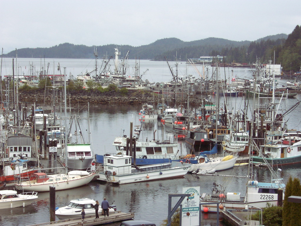
Harbor at Port Hardy (not the ferry landing though).
I went to buy my ferry ticket early in the morning of my day off, but the computer system for the whole ferry system was down. I was able to buy my ticket later on in the day though. I didn’t want to leave that task to the day I was taking the ferry (which turned out to be a wise plan). Then I came back to camp and planned my departure in the morning. The ferry landing was less than a mile away from the camp, so getting there was no problem, but the rain might be.
The ferry was leaving at 6:30 am, but I woke up at 4:00. I ate a quick breakfast, and then got everything stowed on my bicycle. I had a plan if it rained. I had one waterproof bag with dry clothes to change into, and another bag to put wet clothes in (if worst came to worst).
It began to rain lightly as I left the campground. By the time I queued up to board the ferry the worst did come, and I was dripping water when I got on the ferry. People on the ferry stared at me. I guess they wondered what kind of fool would board a ferry with a bicycle on a day like today.
After changing to dry clothes, and buying a latte and some chocolate kisses I went to the Prince of Wales Lounge on the ferry. There I was surrounded by a cluster of Germans. What a dour bunch. Later on a more energized German came in though, and he got them all going.
I had a reservation at Wildwoods Campsite “on the road to the ferry” at Port Hardy — shaded sites, flush toilets, showers…. The lady on the phone seemed cheerful about my arrival at 10:30 pm. I rode to the campground as soon as I got off the ferry, and there she was. I discovered that there were no lights in the tent camping area though.
All I had was a small flashlight, and it was drizzling. Oh well. I just got my tent pitched, and my gear inside it when a young woman arrived in the dark on her bicycle. I helped her find a somewhat level spot and pitch her tent. Then I retired for the night. It was after midnight, so I went right to sleep. I probably dreamed about my plans for the next day.

 The climb over Washington and Rainy passes was challenging. I was trying to stay ahead of the rain, which chased me all the way to the top. It took six hours. I did get a few sprinkles, but stayed dry.
 I went to the cultural center in Alert Bay, but it was closing at noon, as I recall. The caretaker talked with me a few minutes before closing.
 Camping was interesting. The designated campground was just a big, grassy area. The ground sloped down to the “Ocean” which is what they call the sound here, but I found a more-or-less level spot for my tent further up. I had a grand view of several ferry routes (you can see the Fulford Harbor to Sidney ferry in the panorama, click to embiggen). Ferry boats of all shapes and sizes were coming and going in various directions.
 I met two bicycle tourists just as I arrived at Prince Rupert, the City of Rainbows. They were starting out at Prince Rupert because that’s where the Yellowhead Highway starts. He is going to spend the summer going across Canada, and she is riding to Jasper, Alberta. I got them to take my picture in front of the Prince Rupert welcome sign. I am wearing the top half of my rain gear (helmet cover and jacket) to keep warm. It’s not raining, so my rain pants are still stashed in one of my panniers.