Pelly Crossing was my next stop after Carmacks. It’s another First Nations town — about 300 people. I camped right by the Pelly River. It is about the same size as the Yukon was at Carmacks. They join at Fort Campbell. Robert Thompson, son of the legendary explorer David Thompson, established Fort Campbell as a trading post.
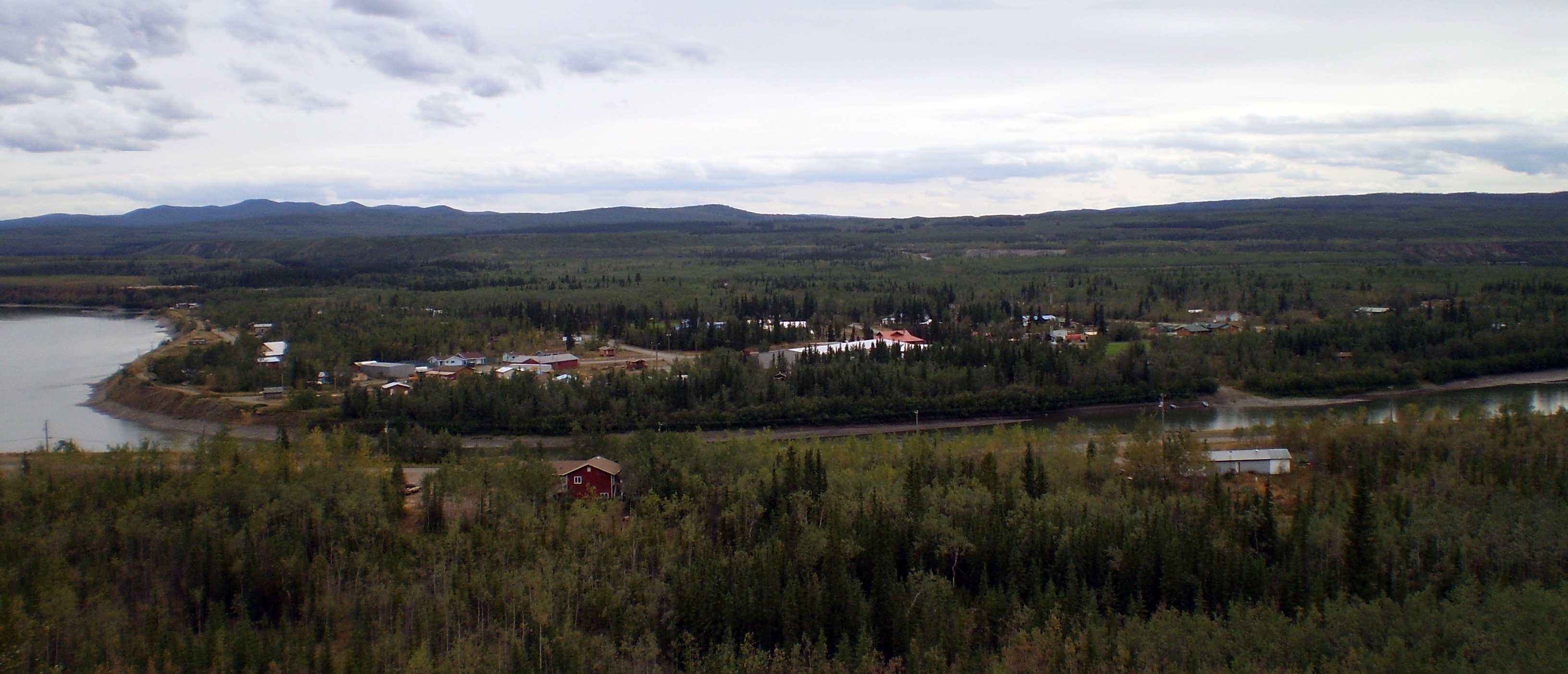
The ride here was tough. There were three big climbs. The road on one of them was under construction. I passed through a big — 500 square miles — burn on the way. This is dry country. The fire was probably started by lightning.
The town sits in a pretty spot. There were many big Ravens in Pelly Crossing. I don’t know what attracts them. My notes say the people were friendly, but that’s not surprising up here. I camped on my own little knoll right by the river.
I enjoyed the sound of rain on a tin roof the next night at Moose Creek Lodge. I had stopped to eat there and soon the rain started. The lodge offered hot showers, and I thought that would be nice. But getting a room seemed nicer when the rain started. It had gotten cold and there was no telling when the rain would stop.
The hot showers were separate, and the “room” was a tiny log cabin with a tin roof. It also had a front porch where I could put my bike out of the rain. It was heated by a propane stove, which made it much cozier than a tent. Listening to the rain on the roof put me to sleep. What luxury.
It stopped raining by morning, but it was a gray day. I got going after breakfast in the lodge. I hoped it wouldn’t rain. It was 100 miles to Dawson City so I decided to take two days to do it.
I met a young couple from France coming toward me. They had started in Anchorage, ridden through much of Alaska, and were returning from Fort McPherson. That was 600-mile side trip (total) beyond the Artic Circle on the Dempster Highway. They were now on their way to South America.
I thought about going up there too, on and off, for the rest of the day. The fact that it was a gravel road helped me decide not to go. That saved me a couple of weeks, but now I wish I had gone.
I had planned to go 50 miles the first day after leaving Pelly Crossing, but I found no inviting campsites at that point. I went on to an overlook at 60 miles. Nothing there either It was downhill from there so I continued on. I ended up at the Klondike Lodge at the intersection with the Dempster Highway. I was now 500 miles from Skagway. No, I still wasn’t going to Fort McPherson.
I had camped across the highway from the lodge. A hitchhiker who was waiting for a ride to Fort McPherson joined me. It was 11:30 pm by then and the sun was still up. I didn’t wait for it to set, I went to bed. One nice thing about cycling: You don’t have any trouble sleeping.
I arrived at the Guggie Ville campground, a couple of miles outside Dawson City, early the next day. It sits on top of tailings from the gold dredging operations on Bonanza Creek. I went to Dawson City in the afternoon. I looked around, and I would be back the next day.
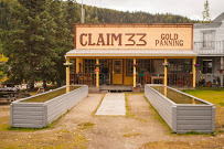 Panning for gold is one of the attractions at Guggie Ville. The have two troughs of sand and water that they salt with gold flakes. I had some fun learning to pan, but I no longer know what happened to the flakes I found.
The couple who owned the place spent 20 years scrounging for gold and decided to quit and build Guggie Ville. (Maybe their name is Googie?) On the last day they looked for gold, they found a 20 oz. nugget. The woman I talked with said not going back was the hardest thing they ever did.
[pictures]

I am keeping up on the details of your trip. Some memories!
LikeLike